You are here: Home > Network List > CI - Caltech Regional Seismic Network Stations List
> Station BAR Barrett, Tecate, CA, USA > Earthquake Result Viewer
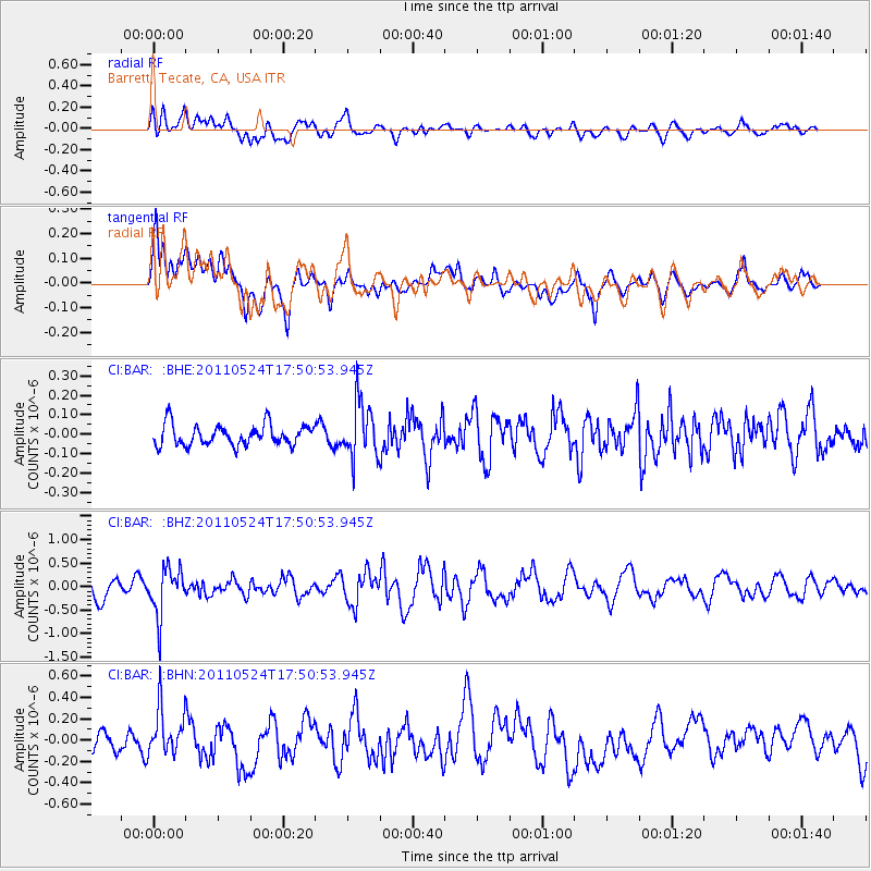
BAR Barrett, Tecate, CA, USA - Earthquake Result Viewer
*The percent match for this event was below the threshold and hence no stack was calculated.
| Earthquake location: |
Andreanof Islands, Aleutian Is. |
| Earthquake latitude/longitude: |
52.6/-173.3 |
| Earthquake time(UTC): |
2011/05/24 (144) 17:43:24 GMT |
| Earthquake Depth: |
138 km |
| Earthquake Magnitude: |
5.6 MB, 5.5 MW, 5.5 MW |
| Earthquake Catalog/Contributor: |
WHDF/NEIC |
|
| Network: |
CI Caltech Regional Seismic Network |
| Station: |
BAR Barrett, Tecate, CA, USA |
| Lat/Lon: |
32.68 N/116.67 W |
| Elevation: |
521 m |
|
| Distance: |
44.8 deg |
| Az: |
93.27 deg |
| Baz: |
313.768 deg |
| Ray Param: |
$rayparam |
*The percent match for this event was below the threshold and hence was not used in the summary stack. |
|
| Radial Match: |
56.131397 % |
| Radial Bump: |
400 |
| Transverse Match: |
60.970882 % |
| Transverse Bump: |
400 |
| SOD ConfigId: |
393008 |
| Insert Time: |
2011-10-28 08:56:00.251 +0000 |
| GWidth: |
2.5 |
| Max Bumps: |
400 |
| Tol: |
0.001 |
|
Signal To Noise
| Channel | StoN | STA | LTA |
| CI:BAR: :BHZ:20110524T17:50:53.945Z | 2.4745667 | 5.0802873E-7 | 2.0530007E-7 |
| CI:BAR: :BHN:20110524T17:50:53.945Z | 2.0333695 | 2.2317224E-7 | 1.0975488E-7 |
| CI:BAR: :BHE:20110524T17:50:53.945Z | 2.6126559 | 1.3976371E-7 | 5.349488E-8 |
| Arrivals |
| Ps | |
| PpPs | |
| PsPs/PpSs | |


