You are here: Home > Network List > CI - Caltech Regional Seismic Network Stations List
> Station SMM Simmler, CA, USA > Earthquake Result Viewer
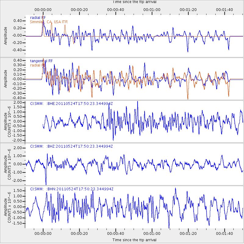
SMM Simmler, CA, USA - Earthquake Result Viewer
*The percent match for this event was below the threshold and hence no stack was calculated.
| Earthquake location: |
Andreanof Islands, Aleutian Is. |
| Earthquake latitude/longitude: |
52.6/-173.3 |
| Earthquake time(UTC): |
2011/05/24 (144) 17:43:24 GMT |
| Earthquake Depth: |
138 km |
| Earthquake Magnitude: |
5.6 MB, 5.5 MW, 5.5 MW |
| Earthquake Catalog/Contributor: |
WHDF/NEIC |
|
| Network: |
CI Caltech Regional Seismic Network |
| Station: |
SMM Simmler, CA, USA |
| Lat/Lon: |
35.31 N/120.00 W |
| Elevation: |
599 m |
|
| Distance: |
41.0 deg |
| Az: |
93.197 deg |
| Baz: |
311.864 deg |
| Ray Param: |
$rayparam |
*The percent match for this event was below the threshold and hence was not used in the summary stack. |
|
| Radial Match: |
45.66115 % |
| Radial Bump: |
400 |
| Transverse Match: |
60.301716 % |
| Transverse Bump: |
400 |
| SOD ConfigId: |
393008 |
| Insert Time: |
2011-10-28 08:58:14.606 +0000 |
| GWidth: |
2.5 |
| Max Bumps: |
400 |
| Tol: |
0.001 |
|
Signal To Noise
| Channel | StoN | STA | LTA |
| CI:SMM: :BHZ:20110524T17:50:23.344994Z | 2.0721407 | 7.7476E-7 | 3.7389356E-7 |
| CI:SMM: :BHN:20110524T17:50:23.344994Z | 1.2060515 | 7.6889705E-7 | 6.3753254E-7 |
| CI:SMM: :BHE:20110524T17:50:23.344994Z | 1.211955 | 4.895344E-7 | 4.039213E-7 |
| Arrivals |
| Ps | |
| PpPs | |
| PsPs/PpSs | |


