You are here: Home > Network List > TA - USArray Transportable Network (new EarthScope stations) Stations List
> Station D28A Regan, ND, USA > Earthquake Result Viewer
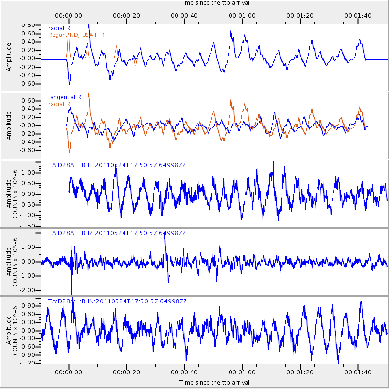
D28A Regan, ND, USA - Earthquake Result Viewer
*The percent match for this event was below the threshold and hence no stack was calculated.
| Earthquake location: |
Andreanof Islands, Aleutian Is. |
| Earthquake latitude/longitude: |
52.6/-173.3 |
| Earthquake time(UTC): |
2011/05/24 (144) 17:43:24 GMT |
| Earthquake Depth: |
138 km |
| Earthquake Magnitude: |
5.6 MB, 5.5 MW, 5.5 MW |
| Earthquake Catalog/Contributor: |
WHDF/NEIC |
|
| Network: |
TA USArray Transportable Network (new EarthScope stations) |
| Station: |
D28A Regan, ND, USA |
| Lat/Lon: |
47.19 N/100.57 W |
| Elevation: |
621 m |
|
| Distance: |
45.3 deg |
| Az: |
66.336 deg |
| Baz: |
304.991 deg |
| Ray Param: |
$rayparam |
*The percent match for this event was below the threshold and hence was not used in the summary stack. |
|
| Radial Match: |
58.797638 % |
| Radial Bump: |
400 |
| Transverse Match: |
50.76397 % |
| Transverse Bump: |
400 |
| SOD ConfigId: |
393008 |
| Insert Time: |
2011-10-28 09:11:35.442 +0000 |
| GWidth: |
2.5 |
| Max Bumps: |
400 |
| Tol: |
0.001 |
|
Signal To Noise
| Channel | StoN | STA | LTA |
| TA:D28A: :BHZ:20110524T17:50:57.649987Z | 2.3319395 | 5.588558E-7 | 2.396528E-7 |
| TA:D28A: :BHN:20110524T17:50:57.649987Z | 1.265608 | 4.69375E-7 | 3.708692E-7 |
| TA:D28A: :BHE:20110524T17:50:57.649987Z | 1.0082053 | 4.67014E-7 | 4.6321318E-7 |
| Arrivals |
| Ps | |
| PpPs | |
| PsPs/PpSs | |


