ENH Enshi, Hubei Province, China - Earthquake Result Viewer
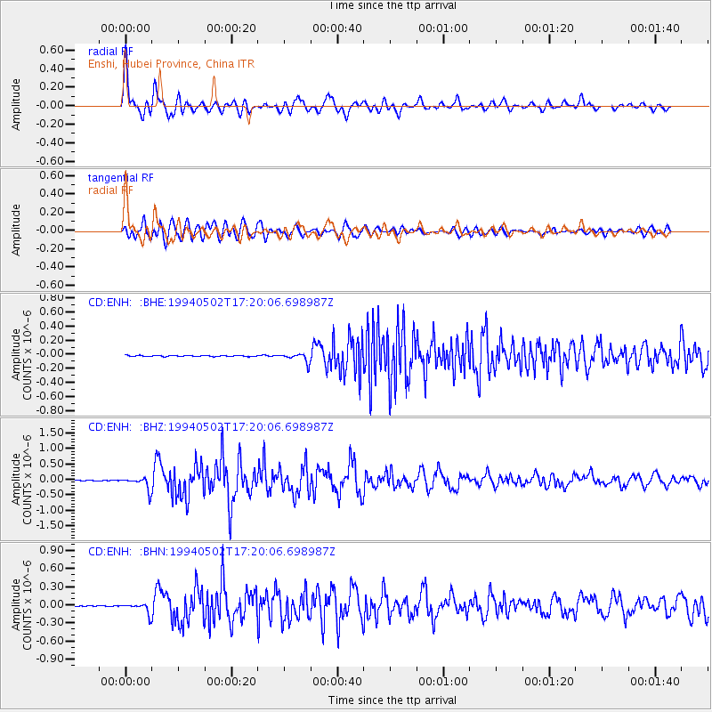
Earthquake location: Southwest Of Sumatra, Indonesia
Earthquake latitude/longitude: -1.1/97.6
Earthquake time(UTC): 1994/05/02 (122) 17:14:03 GMT
Earthquake Depth: 38 km
Earthquake Magnitude: 6.1 MB, 5.8 MS, 5.6 UNKNOWN, 6.0 MW
Earthquake Catalog/Contributor: WHDF/NEIC
Network: CD China Digital Seismograph Network
Station: ENH Enshi, Hubei Province, China
Lat/Lon: 30.27 N/109.49 E
Elevation: 487 m
Distance: 33.2 deg
Az: 18.978 deg
Baz: 202.076 deg
Ray Param: 0.07824943
Estimated Moho Depth: 48.25 km
Estimated Crust Vp/Vs: 1.66
Assumed Crust Vp: 6.083 km/s
Estimated Crust Vs: 3.659 km/s
Estimated Crust Poisson's Ratio: 0.22
Radial Match: 91.123924 %
Radial Bump: 400
Transverse Match: 77.298615 %
Transverse Bump: 400
SOD ConfigId: 4480
Insert Time: 2010-02-26 21:20:34.645 +0000
GWidth: 2.5
Max Bumps: 400
Tol: 0.001

Signal To Noise

ChannelStoNSTALTA
CD:ENH: :BHZ:19940502T17:20:06.698987Z19.3252962.1462658E-71.1105992E-8
CD:ENH: :BHN:19940502T17:20:06.698987Z12.5676449.282784E-87.386256E-9
CD:ENH: :BHE:19940502T17:20:06.698987Z7.8541326.443161E-88.20353E-9
Arrivals
Ps5.7 SECOND
PpPs20 SECOND
PsPs/PpSs25 SECOND