You are here: Home > Network List > TA - USArray Transportable Network (new EarthScope stations) Stations List
> Station 434A Burnet, TX, USA > Earthquake Result Viewer
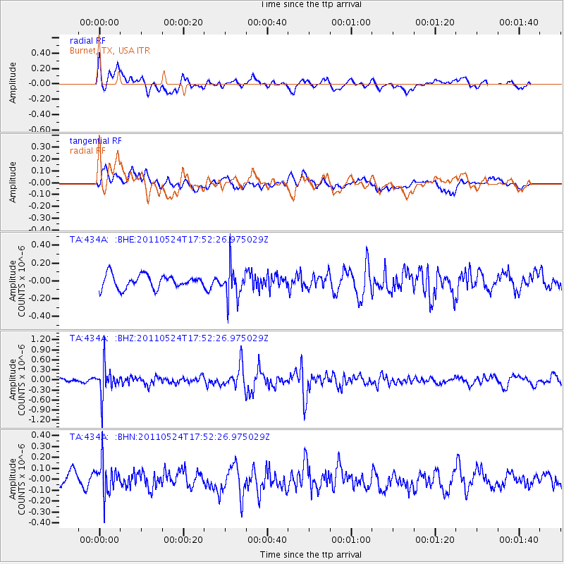
434A Burnet, TX, USA - Earthquake Result Viewer
*The percent match for this event was below the threshold and hence no stack was calculated.
| Earthquake location: |
Andreanof Islands, Aleutian Is. |
| Earthquake latitude/longitude: |
52.6/-173.3 |
| Earthquake time(UTC): |
2011/05/24 (144) 17:43:24 GMT |
| Earthquake Depth: |
138 km |
| Earthquake Magnitude: |
5.6 MB, 5.5 MW, 5.5 MW |
| Earthquake Catalog/Contributor: |
WHDF/NEIC |
|
| Network: |
TA USArray Transportable Network (new EarthScope stations) |
| Station: |
434A Burnet, TX, USA |
| Lat/Lon: |
30.81 N/98.27 W |
| Elevation: |
462 m |
|
| Distance: |
57.3 deg |
| Az: |
80.817 deg |
| Baz: |
315.578 deg |
| Ray Param: |
$rayparam |
*The percent match for this event was below the threshold and hence was not used in the summary stack. |
|
| Radial Match: |
65.15498 % |
| Radial Bump: |
400 |
| Transverse Match: |
56.19781 % |
| Transverse Bump: |
400 |
| SOD ConfigId: |
393008 |
| Insert Time: |
2011-10-28 09:15:00.035 +0000 |
| GWidth: |
2.5 |
| Max Bumps: |
400 |
| Tol: |
0.001 |
|
Signal To Noise
| Channel | StoN | STA | LTA |
| TA:434A: :BHZ:20110524T17:52:26.975029Z | 4.476567 | 4.390937E-7 | 9.8087156E-8 |
| TA:434A: :BHN:20110524T17:52:26.975029Z | 1.9666219 | 1.464077E-7 | 7.4446284E-8 |
| TA:434A: :BHE:20110524T17:52:26.975029Z | 2.3890553 | 1.7908539E-7 | 7.496076E-8 |
| Arrivals |
| Ps | |
| PpPs | |
| PsPs/PpSs | |


