You are here: Home > Network List > TA - USArray Transportable Network (new EarthScope stations) Stations List
> Station 433A Art, TX, USA > Earthquake Result Viewer
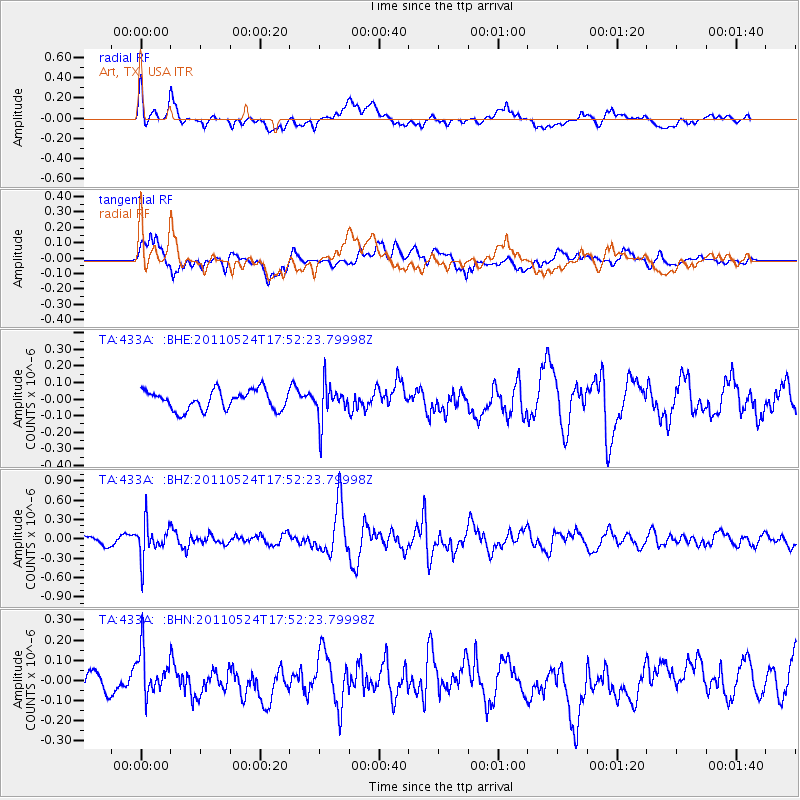
433A Art, TX, USA - Earthquake Result Viewer
*The percent match for this event was below the threshold and hence no stack was calculated.
| Earthquake location: |
Andreanof Islands, Aleutian Is. |
| Earthquake latitude/longitude: |
52.6/-173.3 |
| Earthquake time(UTC): |
2011/05/24 (144) 17:43:24 GMT |
| Earthquake Depth: |
138 km |
| Earthquake Magnitude: |
5.6 MB, 5.5 MW, 5.5 MW |
| Earthquake Catalog/Contributor: |
WHDF/NEIC |
|
| Network: |
TA USArray Transportable Network (new EarthScope stations) |
| Station: |
433A Art, TX, USA |
| Lat/Lon: |
30.75 N/99.09 W |
| Elevation: |
447 m |
|
| Distance: |
56.9 deg |
| Az: |
81.468 deg |
| Baz: |
315.513 deg |
| Ray Param: |
$rayparam |
*The percent match for this event was below the threshold and hence was not used in the summary stack. |
|
| Radial Match: |
63.622158 % |
| Radial Bump: |
400 |
| Transverse Match: |
65.62156 % |
| Transverse Bump: |
400 |
| SOD ConfigId: |
393008 |
| Insert Time: |
2011-10-28 09:15:15.429 +0000 |
| GWidth: |
2.5 |
| Max Bumps: |
400 |
| Tol: |
0.001 |
|
Signal To Noise
| Channel | StoN | STA | LTA |
| TA:433A: :BHZ:20110524T17:52:23.79998Z | 3.2618089 | 2.6447265E-7 | 8.1081595E-8 |
| TA:433A: :BHN:20110524T17:52:23.79998Z | 2.217486 | 1.206181E-7 | 5.4394075E-8 |
| TA:433A: :BHE:20110524T17:52:23.79998Z | 1.8304217 | 1.0711905E-7 | 5.8521515E-8 |
| Arrivals |
| Ps | |
| PpPs | |
| PsPs/PpSs | |


