You are here: Home > Network List > TA - USArray Transportable Network (new EarthScope stations) Stations List
> Station 340A Bronson, TX, USA > Earthquake Result Viewer
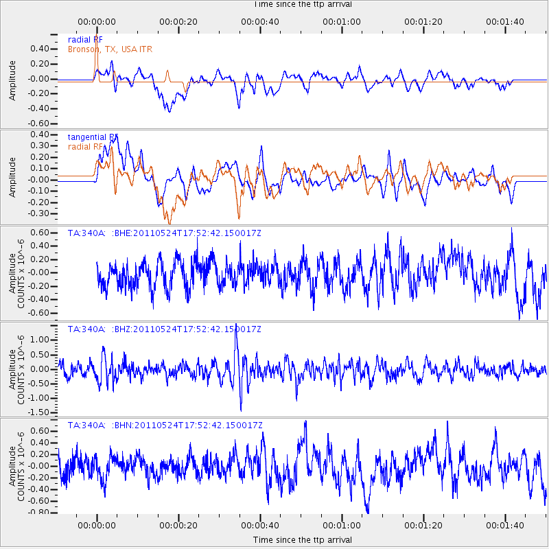
340A Bronson, TX, USA - Earthquake Result Viewer
*The percent match for this event was below the threshold and hence no stack was calculated.
| Earthquake location: |
Andreanof Islands, Aleutian Is. |
| Earthquake latitude/longitude: |
52.6/-173.3 |
| Earthquake time(UTC): |
2011/05/24 (144) 17:43:24 GMT |
| Earthquake Depth: |
138 km |
| Earthquake Magnitude: |
5.6 MB, 5.5 MW, 5.5 MW |
| Earthquake Catalog/Contributor: |
WHDF/NEIC |
|
| Network: |
TA USArray Transportable Network (new EarthScope stations) |
| Station: |
340A Bronson, TX, USA |
| Lat/Lon: |
31.42 N/93.89 W |
| Elevation: |
57 m |
|
| Distance: |
59.5 deg |
| Az: |
77.168 deg |
| Baz: |
315.919 deg |
| Ray Param: |
$rayparam |
*The percent match for this event was below the threshold and hence was not used in the summary stack. |
|
| Radial Match: |
45.36905 % |
| Radial Bump: |
400 |
| Transverse Match: |
43.77882 % |
| Transverse Bump: |
400 |
| SOD ConfigId: |
393008 |
| Insert Time: |
2011-10-28 09:17:30.703 +0000 |
| GWidth: |
2.5 |
| Max Bumps: |
400 |
| Tol: |
0.001 |
|
Signal To Noise
| Channel | StoN | STA | LTA |
| TA:340A: :BHZ:20110524T17:52:42.150017Z | 2.336832 | 4.2250105E-7 | 1.8080078E-7 |
| TA:340A: :BHN:20110524T17:52:42.150017Z | 1.2700214 | 2.0139919E-7 | 1.5857937E-7 |
| TA:340A: :BHE:20110524T17:52:42.150017Z | 0.7229097 | 1.3693138E-7 | 1.8941698E-7 |
| Arrivals |
| Ps | |
| PpPs | |
| PsPs/PpSs | |


