You are here: Home > Network List > TA - USArray Transportable Network (new EarthScope stations) Stations List
> Station O33A Hebron, NE, USA > Earthquake Result Viewer
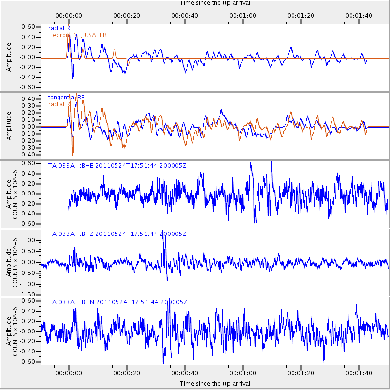
O33A Hebron, NE, USA - Earthquake Result Viewer
*The percent match for this event was below the threshold and hence no stack was calculated.
| Earthquake location: |
Andreanof Islands, Aleutian Is. |
| Earthquake latitude/longitude: |
52.6/-173.3 |
| Earthquake time(UTC): |
2011/05/24 (144) 17:43:24 GMT |
| Earthquake Depth: |
138 km |
| Earthquake Magnitude: |
5.6 MB, 5.5 MW, 5.5 MW |
| Earthquake Catalog/Contributor: |
WHDF/NEIC |
|
| Network: |
TA USArray Transportable Network (new EarthScope stations) |
| Station: |
O33A Hebron, NE, USA |
| Lat/Lon: |
40.08 N/97.58 W |
| Elevation: |
480 m |
|
| Distance: |
51.4 deg |
| Az: |
72.06 deg |
| Baz: |
310.858 deg |
| Ray Param: |
$rayparam |
*The percent match for this event was below the threshold and hence was not used in the summary stack. |
|
| Radial Match: |
55.88987 % |
| Radial Bump: |
400 |
| Transverse Match: |
55.35404 % |
| Transverse Bump: |
400 |
| SOD ConfigId: |
393008 |
| Insert Time: |
2011-10-28 09:18:59.940 +0000 |
| GWidth: |
2.5 |
| Max Bumps: |
400 |
| Tol: |
0.001 |
|
Signal To Noise
| Channel | StoN | STA | LTA |
| TA:O33A: :BHZ:20110524T17:51:44.200005Z | 2.586261 | 2.399541E-7 | 9.2780304E-8 |
| TA:O33A: :BHN:20110524T17:51:44.200005Z | 1.4962848 | 1.9166303E-7 | 1.2809261E-7 |
| TA:O33A: :BHE:20110524T17:51:44.200005Z | 1.4441891 | 1.5245647E-7 | 1.0556545E-7 |
| Arrivals |
| Ps | |
| PpPs | |
| PsPs/PpSs | |


