ENH Enshi, Hubei Province, China - Earthquake Result Viewer
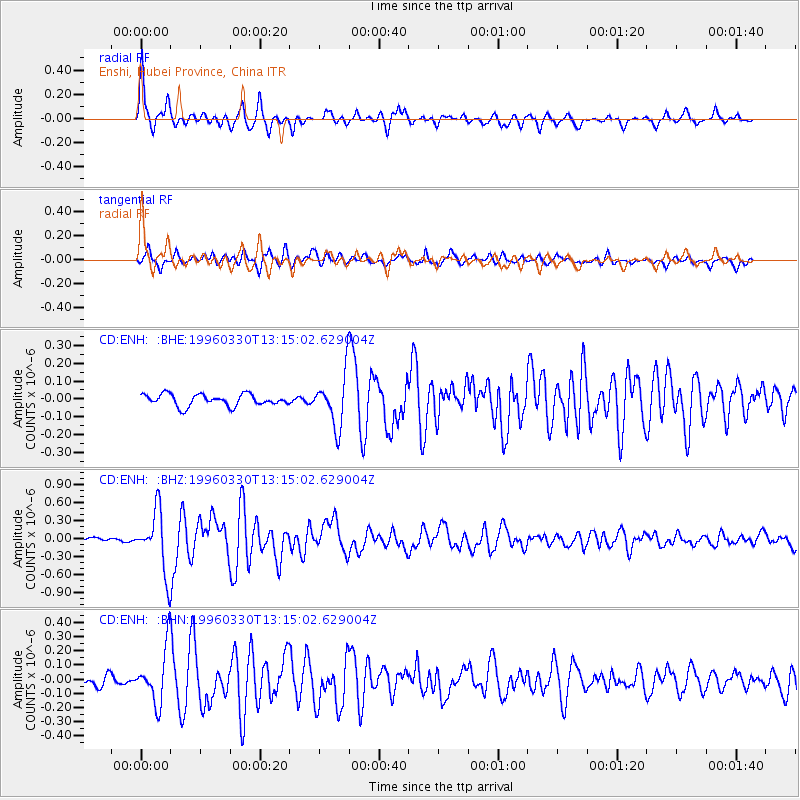
Earthquake location: Fox Islands, Aleutian Islands
Earthquake latitude/longitude: 52.2/-168.7
Earthquake time(UTC): 1996/03/30 (090) 13:05:17 GMT
Earthquake Depth: 33 km
Earthquake Magnitude: 5.9 MB, 6.2 MS, 6.3 UNKNOWN, 6.1 ML
Earthquake Catalog/Contributor: WHDF/NEIC
Network: CD China Digital Seismograph Network
Station: ENH Enshi, Hubei Province, China
Lat/Lon: 30.27 N/109.49 E
Elevation: 487 m
Distance: 61.9 deg
Az: 283.85 deg
Baz: 43.673 deg
Ray Param: 0.060547374
Estimated Moho Depth: 41.0 km
Estimated Crust Vp/Vs: 1.64
Assumed Crust Vp: 6.083 km/s
Estimated Crust Vs: 3.698 km/s
Estimated Crust Poisson's Ratio: 0.21
Radial Match: 89.41529 %
Radial Bump: 400
Transverse Match: 82.79245 %
Transverse Bump: 400
SOD ConfigId: 4480
Insert Time: 2010-02-26 21:20:39.061 +0000
GWidth: 2.5
Max Bumps: 400
Tol: 0.001

Signal To Noise

ChannelStoNSTALTA
CD:ENH: :BHZ:19960330T13:15:02.629004Z19.8711514.9979116E-72.5151598E-8
CD:ENH: :BHN:19960330T13:15:02.629004Z6.50312231.9347051E-72.9750403E-8
CD:ENH: :BHE:19960330T13:15:02.629004Z4.42722371.460299E-73.298453E-8
Arrivals
Ps4.5 SECOND
PpPs17 SECOND
PsPs/PpSs22 SECOND