You are here: Home > Network List > TA - USArray Transportable Network (new EarthScope stations) Stations List
> Station E31A Nome, ND, USA > Earthquake Result Viewer
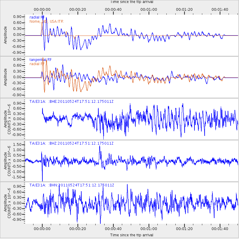
E31A Nome, ND, USA - Earthquake Result Viewer
*The percent match for this event was below the threshold and hence no stack was calculated.
| Earthquake location: |
Andreanof Islands, Aleutian Is. |
| Earthquake latitude/longitude: |
52.6/-173.3 |
| Earthquake time(UTC): |
2011/05/24 (144) 17:43:24 GMT |
| Earthquake Depth: |
138 km |
| Earthquake Magnitude: |
5.6 MB, 5.5 MW, 5.5 MW |
| Earthquake Catalog/Contributor: |
WHDF/NEIC |
|
| Network: |
TA USArray Transportable Network (new EarthScope stations) |
| Station: |
E31A Nome, ND, USA |
| Lat/Lon: |
46.56 N/97.89 W |
| Elevation: |
427 m |
|
| Distance: |
47.2 deg |
| Az: |
65.564 deg |
| Baz: |
306.407 deg |
| Ray Param: |
$rayparam |
*The percent match for this event was below the threshold and hence was not used in the summary stack. |
|
| Radial Match: |
68.17375 % |
| Radial Bump: |
400 |
| Transverse Match: |
62.941235 % |
| Transverse Bump: |
400 |
| SOD ConfigId: |
393008 |
| Insert Time: |
2011-10-28 09:21:38.488 +0000 |
| GWidth: |
2.5 |
| Max Bumps: |
400 |
| Tol: |
0.001 |
|
Signal To Noise
| Channel | StoN | STA | LTA |
| TA:E31A: :BHZ:20110524T17:51:12.175011Z | 4.252577 | 4.3403602E-7 | 1.0206424E-7 |
| TA:E31A: :BHN:20110524T17:51:12.175011Z | 1.456532 | 3.237853E-7 | 2.2229878E-7 |
| TA:E31A: :BHE:20110524T17:51:12.175011Z | 2.284834 | 4.0928768E-7 | 1.7913236E-7 |
| Arrivals |
| Ps | |
| PpPs | |
| PsPs/PpSs | |


