You are here: Home > Network List > TA - USArray Transportable Network (new EarthScope stations) Stations List
> Station F31A Hecla, SD, USA > Earthquake Result Viewer
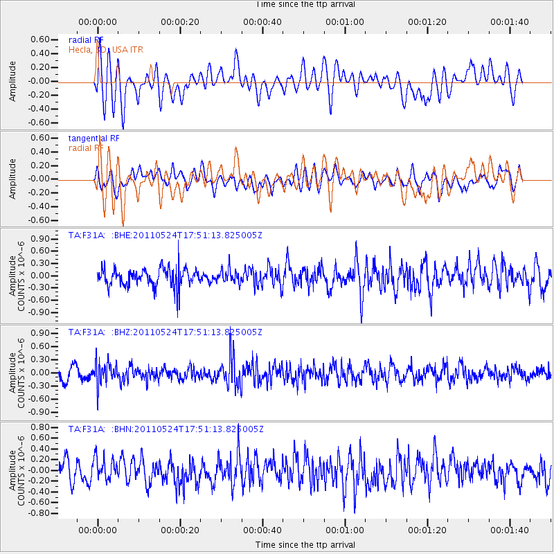
F31A Hecla, SD, USA - Earthquake Result Viewer
*The percent match for this event was below the threshold and hence no stack was calculated.
| Earthquake location: |
Andreanof Islands, Aleutian Is. |
| Earthquake latitude/longitude: |
52.6/-173.3 |
| Earthquake time(UTC): |
2011/05/24 (144) 17:43:24 GMT |
| Earthquake Depth: |
138 km |
| Earthquake Magnitude: |
5.6 MB, 5.5 MW, 5.5 MW |
| Earthquake Catalog/Contributor: |
WHDF/NEIC |
|
| Network: |
TA USArray Transportable Network (new EarthScope stations) |
| Station: |
F31A Hecla, SD, USA |
| Lat/Lon: |
45.86 N/98.25 W |
| Elevation: |
412 m |
|
| Distance: |
47.4 deg |
| Az: |
66.533 deg |
| Baz: |
306.802 deg |
| Ray Param: |
$rayparam |
*The percent match for this event was below the threshold and hence was not used in the summary stack. |
|
| Radial Match: |
56.82107 % |
| Radial Bump: |
400 |
| Transverse Match: |
43.503685 % |
| Transverse Bump: |
400 |
| SOD ConfigId: |
393008 |
| Insert Time: |
2011-10-28 09:23:07.649 +0000 |
| GWidth: |
2.5 |
| Max Bumps: |
400 |
| Tol: |
0.001 |
|
Signal To Noise
| Channel | StoN | STA | LTA |
| TA:F31A: :BHZ:20110524T17:51:13.825005Z | 1.796567 | 2.544834E-7 | 1.4164983E-7 |
| TA:F31A: :BHN:20110524T17:51:13.825005Z | 0.8145317 | 2.017508E-7 | 2.4768931E-7 |
| TA:F31A: :BHE:20110524T17:51:13.825005Z | 0.75444275 | 1.6273643E-7 | 2.1570415E-7 |
| Arrivals |
| Ps | |
| PpPs | |
| PsPs/PpSs | |


