You are here: Home > Network List > TA - USArray Transportable Network (new EarthScope stations) Stations List
> Station T41A Mountain View, MO, USA > Earthquake Result Viewer
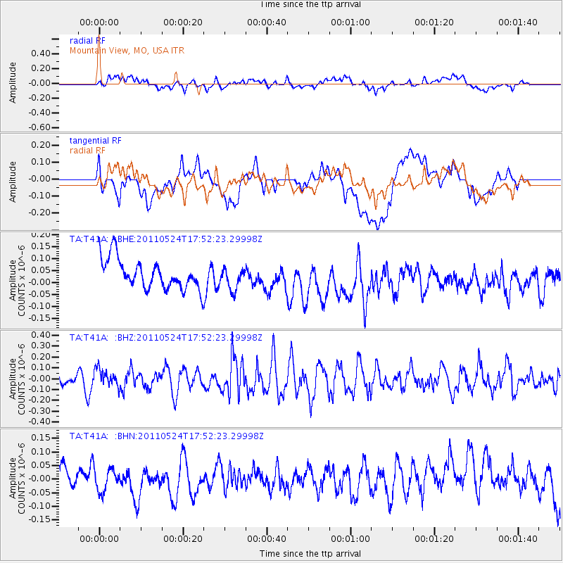
T41A Mountain View, MO, USA - Earthquake Result Viewer
*The percent match for this event was below the threshold and hence no stack was calculated.
| Earthquake location: |
Andreanof Islands, Aleutian Is. |
| Earthquake latitude/longitude: |
52.6/-173.3 |
| Earthquake time(UTC): |
2011/05/24 (144) 17:43:24 GMT |
| Earthquake Depth: |
138 km |
| Earthquake Magnitude: |
5.6 MB, 5.5 MW, 5.5 MW |
| Earthquake Catalog/Contributor: |
WHDF/NEIC |
|
| Network: |
TA USArray Transportable Network (new EarthScope stations) |
| Station: |
T41A Mountain View, MO, USA |
| Lat/Lon: |
37.04 N/91.76 W |
| Elevation: |
366 m |
|
| Distance: |
56.8 deg |
| Az: |
71.023 deg |
| Baz: |
313.866 deg |
| Ray Param: |
$rayparam |
*The percent match for this event was below the threshold and hence was not used in the summary stack. |
|
| Radial Match: |
33.88233 % |
| Radial Bump: |
400 |
| Transverse Match: |
39.616566 % |
| Transverse Bump: |
400 |
| SOD ConfigId: |
393008 |
| Insert Time: |
2011-10-28 09:28:18.955 +0000 |
| GWidth: |
2.5 |
| Max Bumps: |
400 |
| Tol: |
0.001 |
|
Signal To Noise
| Channel | StoN | STA | LTA |
| TA:T41A: :BHZ:20110524T17:52:23.29998Z | 1.0301841 | 7.8215606E-8 | 7.592391E-8 |
| TA:T41A: :BHN:20110524T17:52:23.29998Z | 0.7829559 | 4.459876E-8 | 5.6962033E-8 |
| TA:T41A: :BHE:20110524T17:52:23.29998Z | 0.7500504 | 4.601439E-8 | 6.1348395E-8 |
| Arrivals |
| Ps | |
| PpPs | |
| PsPs/PpSs | |


