You are here: Home > Network List > UW - Pacific Northwest Regional Seismic Network Stations List
> Station LEBA Lebam, WA, USA > Earthquake Result Viewer
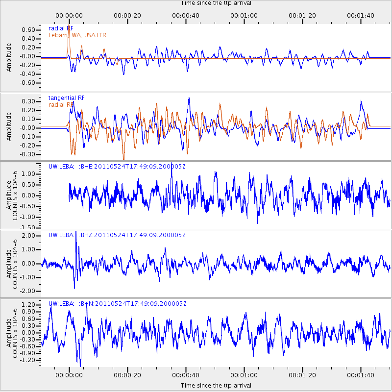
LEBA Lebam, WA, USA - Earthquake Result Viewer
*The percent match for this event was below the threshold and hence no stack was calculated.
| Earthquake location: |
Andreanof Islands, Aleutian Is. |
| Earthquake latitude/longitude: |
52.6/-173.3 |
| Earthquake time(UTC): |
2011/05/24 (144) 17:43:24 GMT |
| Earthquake Depth: |
138 km |
| Earthquake Magnitude: |
5.6 MB, 5.5 MW, 5.5 MW |
| Earthquake Catalog/Contributor: |
WHDF/NEIC |
|
| Network: |
UW Pacific Northwest Regional Seismic Network |
| Station: |
LEBA Lebam, WA, USA |
| Lat/Lon: |
46.55 N/123.56 W |
| Elevation: |
73 m |
|
| Distance: |
32.2 deg |
| Az: |
80.549 deg |
| Baz: |
299.331 deg |
| Ray Param: |
$rayparam |
*The percent match for this event was below the threshold and hence was not used in the summary stack. |
|
| Radial Match: |
50.338196 % |
| Radial Bump: |
400 |
| Transverse Match: |
41.890144 % |
| Transverse Bump: |
400 |
| SOD ConfigId: |
393008 |
| Insert Time: |
2011-10-28 09:31:04.954 +0000 |
| GWidth: |
2.5 |
| Max Bumps: |
400 |
| Tol: |
0.001 |
|
Signal To Noise
| Channel | StoN | STA | LTA |
| UW:LEBA: :BHZ:20110524T17:49:09.200005Z | 3.7326415 | 7.522483E-7 | 2.0153243E-7 |
| UW:LEBA: :BHN:20110524T17:49:09.200005Z | 2.0912106 | 6.7669214E-7 | 3.235887E-7 |
| UW:LEBA: :BHE:20110524T17:49:09.200005Z | 1.338651 | 3.7835915E-7 | 2.8264213E-7 |
| Arrivals |
| Ps | |
| PpPs | |
| PsPs/PpSs | |


