You are here: Home > Network List > TA - USArray Transportable Network (new EarthScope stations) Stations List
> Station 121A Cookes Peak, Deming, NM, USA > Earthquake Result Viewer
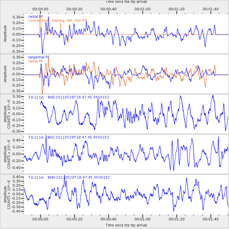
121A Cookes Peak, Deming, NM, USA - Earthquake Result Viewer
*The percent match for this event was below the threshold and hence no stack was calculated.
| Earthquake location: |
Kermadec Islands Region |
| Earthquake latitude/longitude: |
-27.5/-178.5 |
| Earthquake time(UTC): |
2011/05/28 (148) 18:35:52 GMT |
| Earthquake Depth: |
307 km |
| Earthquake Magnitude: |
5.5 MW, 5.3 MB |
| Earthquake Catalog/Contributor: |
WHDF/NEIC |
|
| Network: |
TA USArray Transportable Network (new EarthScope stations) |
| Station: |
121A Cookes Peak, Deming, NM, USA |
| Lat/Lon: |
32.53 N/107.79 W |
| Elevation: |
1652 m |
|
| Distance: |
89.9 deg |
| Az: |
52.889 deg |
| Baz: |
237.019 deg |
| Ray Param: |
$rayparam |
*The percent match for this event was below the threshold and hence was not used in the summary stack. |
|
| Radial Match: |
63.00179 % |
| Radial Bump: |
400 |
| Transverse Match: |
48.573498 % |
| Transverse Bump: |
400 |
| SOD ConfigId: |
393008 |
| Insert Time: |
2011-10-31 23:31:58.801 +0000 |
| GWidth: |
2.5 |
| Max Bumps: |
400 |
| Tol: |
0.001 |
|
Signal To Noise
| Channel | StoN | STA | LTA |
| TA:121A: :BHZ:20110528T18:47:45.650015Z | 1.39842 | 2.183432E-7 | 1.5613564E-7 |
| TA:121A: :BHN:20110528T18:47:45.650015Z | 1.4661598 | 2.2287566E-7 | 1.520132E-7 |
| TA:121A: :BHE:20110528T18:47:45.650015Z | 1.4257052 | 1.7195107E-7 | 1.2060774E-7 |
| Arrivals |
| Ps | |
| PpPs | |
| PsPs/PpSs | |


