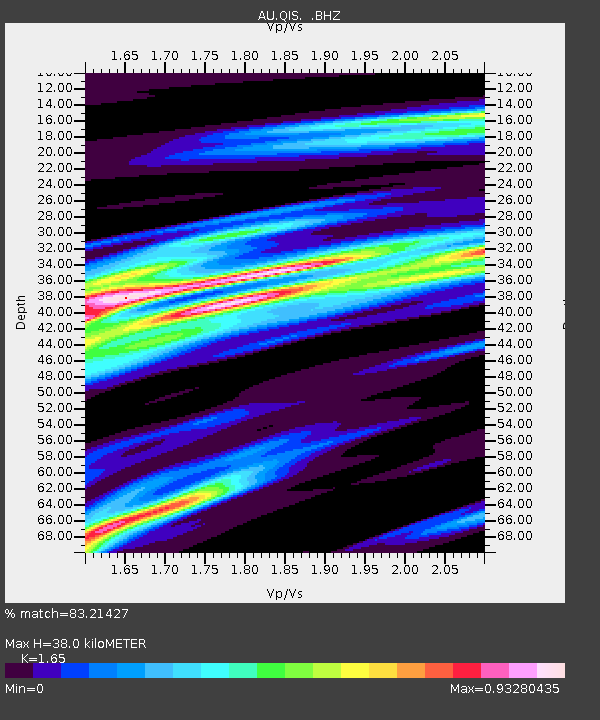
QIS Mount Isa, Queensland - Earthquake Result Viewer

Earthquake location: Southwest Of Sumatra, Indonesia
Earthquake latitude/longitude: -7.7/101.8
Earthquake time(UTC): 2011/05/29 (149) 18:24:01 GMT
Earthquake Depth: 13 km
Earthquake Magnitude: 5.6 MB, 5.4 MS, 5.9 MW, 5.8 MW
Earthquake Catalog/Contributor: WHDF/NEIC
Network: AU Australian Seismological Centre
Station: QIS Mount Isa, Queensland
Lat/Lon: 20.56 S/139.61 E
Elevation: 450 m
Distance: 38.7 deg
Az: 113.272 deg
Baz: 283.698 deg
Ray Param: 0.075375326
Estimated Moho Depth: 38.0 km
Estimated Crust Vp/Vs: 1.65
Assumed Crust Vp: 6.577 km/s
Estimated Crust Vs: 3.986 km/s
Estimated Crust Poisson's Ratio: 0.21
Radial Match: 83.21427 %
Radial Bump: 343
Transverse Match: 56.047783 %
Transverse Bump: 400
SOD ConfigId: 393008
Insert Time: 2011-10-31 23:39:59.323 +0000
GWidth: 2.5
Max Bumps: 400
Tol: 0.001

Signal To Noise

ChannelStoNSTALTA
AU:QIS: :BHZ:20110529T18:30:54.270007Z5.8106079.3119195E-71.6025726E-7
AU:QIS: :BHN:20110529T18:30:54.270007Z1.35778031.9982862E-71.4717301E-7
AU:QIS: :BHE:20110529T18:30:54.270007Z4.62486037.6713496E-71.6587202E-7
Arrivals
Ps4.1 SECOND
PpPs14 SECOND
PsPs/PpSs18 SECOND