You are here: Home > Network List > TA - USArray Transportable Network (new EarthScope stations) Stations List
> Station Y44A Strider, Charleston, MS, USA > Earthquake Result Viewer
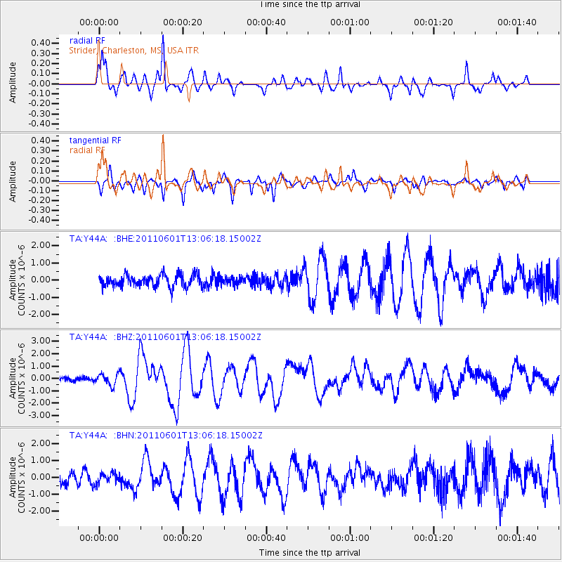
Y44A Strider, Charleston, MS, USA - Earthquake Result Viewer
*The percent match for this event was below the threshold and hence no stack was calculated.
| Earthquake location: |
Near Coast Of Central Chile |
| Earthquake latitude/longitude: |
-37.6/-73.7 |
| Earthquake time(UTC): |
2011/06/01 (152) 12:55:22 GMT |
| Earthquake Depth: |
21 km |
| Earthquake Magnitude: |
5.6 MB, 6.2 MS, 6.3 MW, 6.3 MW |
| Earthquake Catalog/Contributor: |
WHDF/NEIC |
|
| Network: |
TA USArray Transportable Network (new EarthScope stations) |
| Station: |
Y44A Strider, Charleston, MS, USA |
| Lat/Lon: |
33.96 N/90.21 W |
| Elevation: |
46 m |
|
| Distance: |
72.8 deg |
| Az: |
345.678 deg |
| Baz: |
166.322 deg |
| Ray Param: |
$rayparam |
*The percent match for this event was below the threshold and hence was not used in the summary stack. |
|
| Radial Match: |
91.215645 % |
| Radial Bump: |
400 |
| Transverse Match: |
80.1394 % |
| Transverse Bump: |
400 |
| SOD ConfigId: |
393008 |
| Insert Time: |
2011-11-01 00:18:25.047 +0000 |
| GWidth: |
2.5 |
| Max Bumps: |
400 |
| Tol: |
0.001 |
|
Signal To Noise
| Channel | StoN | STA | LTA |
| TA:Y44A: :BHZ:20110601T13:06:18.15002Z | 2.6642854 | 4.7532728E-7 | 1.7840703E-7 |
| TA:Y44A: :BHN:20110601T13:06:18.15002Z | 0.9949348 | 2.944861E-7 | 2.9598533E-7 |
| TA:Y44A: :BHE:20110601T13:06:18.15002Z | 0.6072527 | 2.137619E-7 | 3.5201472E-7 |
| Arrivals |
| Ps | |
| PpPs | |
| PsPs/PpSs | |


