You are here: Home > Network List > CD - China Digital Seismograph Network Stations List
> Station KMI Kunming, Yunnan Province, China > Earthquake Result Viewer
KMI Kunming, Yunnan Province, China - Earthquake Result Viewer

| Earthquake location: |
Andreanof Islands, Aleutian Is. |
| Earthquake latitude/longitude: |
51.1/-178.1 |
| Earthquake time(UTC): |
1992/09/30 (274) 09:42:53 GMT |
| Earthquake Depth: |
33 km |
| Earthquake Magnitude: |
5.9 MB, 5.9 MS, 5.4 ML |
| Earthquake Catalog/Contributor: |
WHDF/NEIC |
|
| Network: |
CD China Digital Seismograph Network |
| Station: |
KMI Kunming, Yunnan Province, China |
| Lat/Lon: |
25.12 N/102.74 E |
| Elevation: |
1975 m |
|
| Distance: |
64.2 deg |
| Az: |
278.494 deg |
| Baz: |
43.412 deg |
| Ray Param: |
0.059046 |
| Estimated Moho Depth: |
42.5 km |
| Estimated Crust Vp/Vs: |
1.80 |
| Assumed Crust Vp: |
6.247 km/s |
| Estimated Crust Vs: |
3.465 km/s |
| Estimated Crust Poisson's Ratio: |
0.28 |
|
| Radial Match: |
89.62476 % |
| Radial Bump: |
400 |
| Transverse Match: |
85.66872 % |
| Transverse Bump: |
400 |
| SOD ConfigId: |
4480 |
| Insert Time: |
2010-02-26 21:21:37.601 +0000 |
| GWidth: |
2.5 |
| Max Bumps: |
400 |
| Tol: |
0.001 |
|
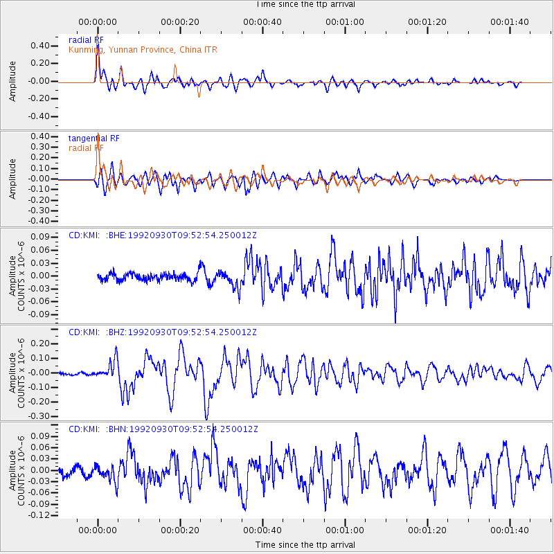
Signal To Noise
| Channel | StoN | STA | LTA |
| CD:KMI: :BHZ:19920930T09:52:54.250012Z | 5.714474 | 6.6753614E-8 | 1.1681496E-8 |
| CD:KMI: :BHN:19920930T09:52:54.250012Z | 2.181315 | 2.2009374E-8 | 1.0089956E-8 |
| CD:KMI: :BHE:19920930T09:52:54.250012Z | 2.379917 | 2.0122732E-8 | 8.455225E-9 |
| Arrivals |
| Ps | 5.7 SECOND |
| PpPs | 18 SECOND |
| PsPs/PpSs | 24 SECOND |


