You are here: Home > Network List > GT - Global Telemetered Seismograph Network (USAF/USGS) Stations List
> Station PLCA Paso Flores, Argentina > Earthquake Result Viewer
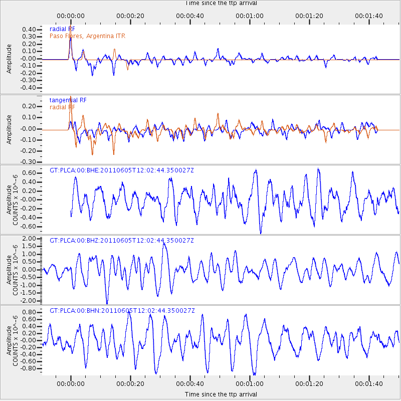
PLCA Paso Flores, Argentina - Earthquake Result Viewer
*The percent match for this event was below the threshold and hence no stack was calculated.
| Earthquake location: |
West Of Macquarie Island |
| Earthquake latitude/longitude: |
-55.8/146.6 |
| Earthquake time(UTC): |
2011/06/05 (156) 11:51:12 GMT |
| Earthquake Depth: |
3.0 km |
| Earthquake Magnitude: |
5.9 MB, 6.4 MS, 6.4 MW, 6.4 MW |
| Earthquake Catalog/Contributor: |
WHDF/NEIC |
|
| Network: |
GT Global Telemetered Seismograph Network (USAF/USGS) |
| Station: |
PLCA Paso Flores, Argentina |
| Lat/Lon: |
40.73 S/70.55 W |
| Elevation: |
1050 m |
|
| Distance: |
78.7 deg |
| Az: |
152.086 deg |
| Baz: |
200.333 deg |
| Ray Param: |
$rayparam |
*The percent match for this event was below the threshold and hence was not used in the summary stack. |
|
| Radial Match: |
76.40819 % |
| Radial Bump: |
326 |
| Transverse Match: |
67.73166 % |
| Transverse Bump: |
400 |
| SOD ConfigId: |
394213 |
| Insert Time: |
2011-11-10 08:43:25.041 +0000 |
| GWidth: |
2.5 |
| Max Bumps: |
400 |
| Tol: |
0.001 |
|
Signal To Noise
| Channel | StoN | STA | LTA |
| GT:PLCA:00:BHZ:20110605T12:02:44.350027Z | 3.5171092 | 6.657973E-7 | 1.8930243E-7 |
| GT:PLCA:00:BHN:20110605T12:02:44.350027Z | 1.203418 | 2.6579258E-7 | 2.208647E-7 |
| GT:PLCA:00:BHE:20110605T12:02:44.350027Z | 1.3012838 | 3.0075267E-7 | 2.3111997E-7 |
| Arrivals |
| Ps | |
| PpPs | |
| PsPs/PpSs | |


