You are here: Home > Network List > BK - Berkeley Digital Seismograph Network Stations List
> Station HUMO Hull Mountain, OR > Earthquake Result Viewer
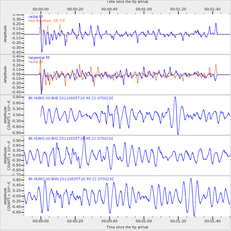
HUMO Hull Mountain, OR - Earthquake Result Viewer
*The percent match for this event was below the threshold and hence no stack was calculated.
| Earthquake location: |
Fiji Islands Region |
| Earthquake latitude/longitude: |
-15.1/-177.9 |
| Earthquake time(UTC): |
2011/06/05 (156) 16:35:04 GMT |
| Earthquake Depth: |
13 km |
| Earthquake Magnitude: |
5.5 MB, 5.8 MS, 5.9 MW, 5.8 MW |
| Earthquake Catalog/Contributor: |
WHDF/NEIC |
|
| Network: |
BK Berkeley Digital Seismograph Network |
| Station: |
HUMO Hull Mountain, OR |
| Lat/Lon: |
42.61 N/122.96 W |
| Elevation: |
555 m |
|
| Distance: |
76.4 deg |
| Az: |
38.436 deg |
| Baz: |
234.415 deg |
| Ray Param: |
$rayparam |
*The percent match for this event was below the threshold and hence was not used in the summary stack. |
|
| Radial Match: |
67.69147 % |
| Radial Bump: |
400 |
| Transverse Match: |
58.750774 % |
| Transverse Bump: |
400 |
| SOD ConfigId: |
394213 |
| Insert Time: |
2011-11-10 08:48:02.509 +0000 |
| GWidth: |
2.5 |
| Max Bumps: |
400 |
| Tol: |
0.001 |
|
Signal To Noise
| Channel | StoN | STA | LTA |
| BK:HUMO:00:BHZ:20110605T16:46:22.070029Z | 1.1212844 | 3.170187E-7 | 2.827282E-7 |
| BK:HUMO:00:BHN:20110605T16:46:22.070029Z | 3.075893 | 3.8752978E-7 | 1.2598936E-7 |
| BK:HUMO:00:BHE:20110605T16:46:22.070029Z | 0.7132852 | 1.6222607E-7 | 2.2743507E-7 |
| Arrivals |
| Ps | |
| PpPs | |
| PsPs/PpSs | |


