You are here: Home > Network List > TA - USArray Transportable Network (new EarthScope stations) Stations List
> Station E30A Jud, ND, USA > Earthquake Result Viewer
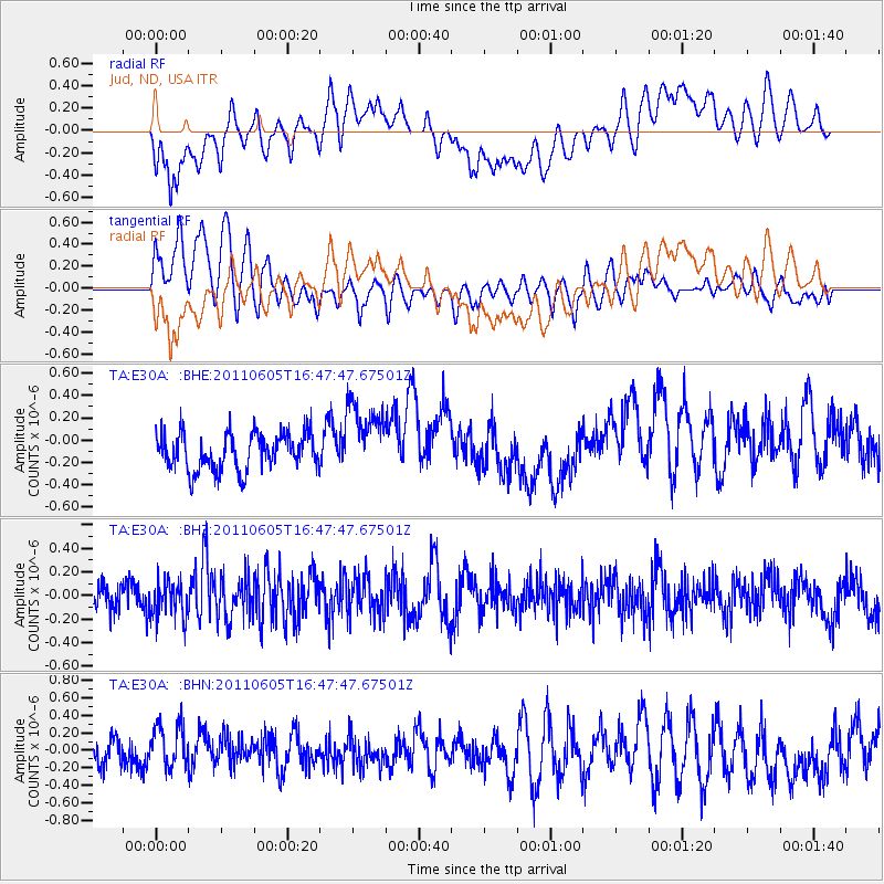
E30A Jud, ND, USA - Earthquake Result Viewer
*The percent match for this event was below the threshold and hence no stack was calculated.
| Earthquake location: |
Fiji Islands Region |
| Earthquake latitude/longitude: |
-15.1/-177.9 |
| Earthquake time(UTC): |
2011/06/05 (156) 16:35:04 GMT |
| Earthquake Depth: |
13 km |
| Earthquake Magnitude: |
5.5 MB, 5.8 MS, 5.9 MW, 5.8 MW |
| Earthquake Catalog/Contributor: |
WHDF/NEIC |
|
| Network: |
TA USArray Transportable Network (new EarthScope stations) |
| Station: |
E30A Jud, ND, USA |
| Lat/Lon: |
46.50 N/98.91 W |
| Elevation: |
544 m |
|
| Distance: |
93.4 deg |
| Az: |
42.783 deg |
| Baz: |
251.754 deg |
| Ray Param: |
$rayparam |
*The percent match for this event was below the threshold and hence was not used in the summary stack. |
|
| Radial Match: |
45.192608 % |
| Radial Bump: |
400 |
| Transverse Match: |
59.144337 % |
| Transverse Bump: |
400 |
| SOD ConfigId: |
394213 |
| Insert Time: |
2011-11-10 08:52:19.890 +0000 |
| GWidth: |
2.5 |
| Max Bumps: |
400 |
| Tol: |
0.001 |
|
Signal To Noise
| Channel | StoN | STA | LTA |
| TA:E30A: :BHZ:20110605T16:47:47.67501Z | 1.1642787 | 1.4806128E-7 | 1.2716995E-7 |
| TA:E30A: :BHN:20110605T16:47:47.67501Z | 1.473143 | 2.490359E-7 | 1.6905074E-7 |
| TA:E30A: :BHE:20110605T16:47:47.67501Z | 2.0557473 | 3.3128435E-7 | 1.6115034E-7 |
| Arrivals |
| Ps | |
| PpPs | |
| PsPs/PpSs | |


