You are here: Home > Network List > AZ - ANZA Regional Network Stations List
> Station SMER AZ.SMER > Earthquake Result Viewer
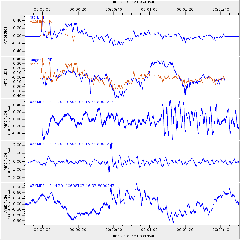
SMER AZ.SMER - Earthquake Result Viewer
*The percent match for this event was below the threshold and hence no stack was calculated.
| Earthquake location: |
Peru-Bolivia Border Region |
| Earthquake latitude/longitude: |
-17.1/-69.5 |
| Earthquake time(UTC): |
2011/06/08 (159) 03:06:22 GMT |
| Earthquake Depth: |
146 km |
| Earthquake Magnitude: |
5.8 MB, 5.9 MW, 5.9 MW |
| Earthquake Catalog/Contributor: |
WHDF/NEIC |
|
| Network: |
AZ ANZA Regional Network |
| Station: |
SMER AZ.SMER |
| Lat/Lon: |
33.46 N/117.17 W |
| Elevation: |
355 m |
|
| Distance: |
67.8 deg |
| Az: |
318.126 deg |
| Baz: |
130.212 deg |
| Ray Param: |
$rayparam |
*The percent match for this event was below the threshold and hence was not used in the summary stack. |
|
| Radial Match: |
38.126472 % |
| Radial Bump: |
400 |
| Transverse Match: |
29.304071 % |
| Transverse Bump: |
400 |
| SOD ConfigId: |
394213 |
| Insert Time: |
2011-11-10 09:07:45.392 +0000 |
| GWidth: |
2.5 |
| Max Bumps: |
400 |
| Tol: |
0.001 |
|
Signal To Noise
| Channel | StoN | STA | LTA |
| AZ:SMER: :BHZ:20110608T03:16:33.800024Z | 2.3148952 | 3.4570553E-7 | 1.493396E-7 |
| AZ:SMER: :BHN:20110608T03:16:33.800024Z | 2.1068518 | 4.970891E-7 | 2.359393E-7 |
| AZ:SMER: :BHE:20110608T03:16:33.800024Z | 1.1137803 | 2.0977886E-7 | 1.8834851E-7 |
| Arrivals |
| Ps | |
| PpPs | |
| PsPs/PpSs | |


