You are here: Home > Network List > CD - China Digital Seismograph Network Stations List
> Station LSA Tibet, China > Earthquake Result Viewer
LSA Tibet, China - Earthquake Result Viewer

| Earthquake location: |
Samar, Philippines |
| Earthquake latitude/longitude: |
12.0/125.7 |
| Earthquake time(UTC): |
1995/04/21 (111) 00:09:56 GMT |
| Earthquake Depth: |
33 km |
| Earthquake Magnitude: |
6.1 MB, 6.9 MS, 6.9 UNKNOWN, 6.8 MW |
| Earthquake Catalog/Contributor: |
WHDF/NEIC |
|
| Network: |
CD China Digital Seismograph Network |
| Station: |
LSA Tibet, China |
| Lat/Lon: |
29.70 N/91.15 E |
| Elevation: |
3789 m |
|
| Distance: |
36.6 deg |
| Az: |
304.118 deg |
| Baz: |
111.407 deg |
| Ray Param: |
0.076539904 |
| Estimated Moho Depth: |
46.5 km |
| Estimated Crust Vp/Vs: |
1.87 |
| Assumed Crust Vp: |
6.514 km/s |
| Estimated Crust Vs: |
3.484 km/s |
| Estimated Crust Poisson's Ratio: |
0.30 |
|
| Radial Match: |
90.530624 % |
| Radial Bump: |
339 |
| Transverse Match: |
74.98481 % |
| Transverse Bump: |
400 |
| SOD ConfigId: |
4480 |
| Insert Time: |
2010-02-26 21:21:59.119 +0000 |
| GWidth: |
2.5 |
| Max Bumps: |
400 |
| Tol: |
0.001 |
|
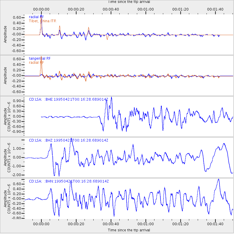
Signal To Noise
| Channel | StoN | STA | LTA |
| CD:LSA: :BHZ:19950421T00:16:28.689014Z | 11.83659 | 3.333066E-7 | 2.8159006E-8 |
| CD:LSA: :BHN:19950421T00:16:28.689014Z | 4.469343 | 8.948141E-8 | 2.0021155E-8 |
| CD:LSA: :BHE:19950421T00:16:28.689014Z | 6.194105 | 1.4241785E-7 | 2.2992483E-8 |
| Arrivals |
| Ps | 6.7 SECOND |
| PpPs | 19 SECOND |
| PsPs/PpSs | 26 SECOND |


