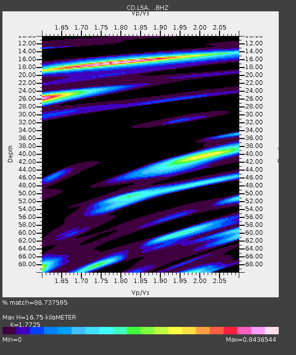
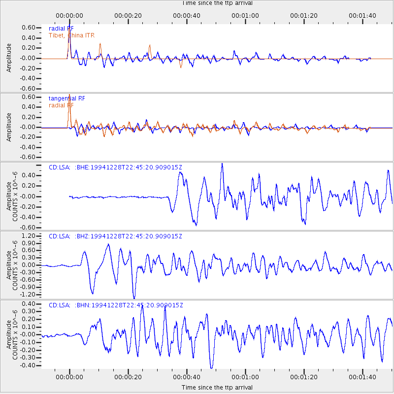
LSA Tibet, China - Earthquake Result Viewer

Earthquake location: Off East Coast Of Honshu, Japan
Earthquake latitude/longitude: 40.2/143.7
Earthquake time(UTC): 1994/12/28 (362) 22:37:49 GMT
Earthquake Depth: 33 km
Earthquake Magnitude: 5.8 MB, 5.9 MS, 5.7 UNKNOWN
Earthquake Catalog/Contributor: WHDF/NEIC
Network: CD China Digital Seismograph Network
Station: LSA Tibet, China
Lat/Lon: 29.70 N/91.15 E
Elevation: 3789 m
Distance: 43.7 deg
Az: 273.04 deg
Baz: 61.46 deg
Ray Param: 0.07228211
Estimated Moho Depth: 16.75 km
Estimated Crust Vp/Vs: 1.77
Assumed Crust Vp: 6.514 km/s
Estimated Crust Vs: 3.675 km/s
Estimated Crust Poisson's Ratio: 0.27
Radial Match: 86.737595 %
Radial Bump: 400
Transverse Match: 76.27111 %
Transverse Bump: 400
SOD ConfigId: 4480
Insert Time: 2010-02-26 21:22:07.830 +0000
GWidth: 2.5
Max Bumps: 400
Tol: 0.001

Signal To Noise

ChannelStoNSTALTA
CD:LSA: :BHZ:19941228T22:45:20.909015Z9.491021.5500727E-71.6331992E-8
CD:LSA: :BHN:19941228T22:45:20.909015Z2.3990562.5520876E-81.0637882E-8
CD:LSA: :BHE:19941228T22:45:20.909015Z7.92543846.920455E-88.731953E-9
Arrivals
Ps2.1 SECOND
PpPs6.7 SECOND
PsPs/PpSs8.8 SECOND