You are here: Home > Network List > TA - USArray Transportable Network (new EarthScope stations) Stations List
> Station J34A George, IA, USA > Earthquake Result Viewer
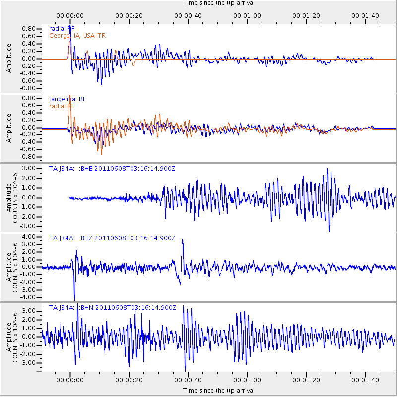
J34A George, IA, USA - Earthquake Result Viewer
*The percent match for this event was below the threshold and hence no stack was calculated.
| Earthquake location: |
Peru-Bolivia Border Region |
| Earthquake latitude/longitude: |
-17.1/-69.5 |
| Earthquake time(UTC): |
2011/06/08 (159) 03:06:22 GMT |
| Earthquake Depth: |
146 km |
| Earthquake Magnitude: |
5.8 MB, 5.9 MW, 5.9 MW |
| Earthquake Catalog/Contributor: |
WHDF/NEIC |
|
| Network: |
TA USArray Transportable Network (new EarthScope stations) |
| Station: |
J34A George, IA, USA |
| Lat/Lon: |
43.28 N/95.96 W |
| Elevation: |
432 m |
|
| Distance: |
64.8 deg |
| Az: |
338.938 deg |
| Baz: |
151.921 deg |
| Ray Param: |
$rayparam |
*The percent match for this event was below the threshold and hence was not used in the summary stack. |
|
| Radial Match: |
74.79017 % |
| Radial Bump: |
400 |
| Transverse Match: |
72.750305 % |
| Transverse Bump: |
400 |
| SOD ConfigId: |
394213 |
| Insert Time: |
2011-11-10 09:37:47.774 +0000 |
| GWidth: |
2.5 |
| Max Bumps: |
400 |
| Tol: |
0.001 |
|
Signal To Noise
| Channel | StoN | STA | LTA |
| TA:J34A: :BHZ:20110608T03:16:14.900Z | 11.892959 | 1.2649157E-6 | 1.06358364E-7 |
| TA:J34A: :BHN:20110608T03:16:14.900Z | 4.298955 | 1.455539E-6 | 3.385797E-7 |
| TA:J34A: :BHE:20110608T03:16:14.900Z | 6.2478075 | 7.2150715E-7 | 1.15481654E-7 |
| Arrivals |
| Ps | |
| PpPs | |
| PsPs/PpSs | |


