You are here: Home > Network List > TA - USArray Transportable Network (new EarthScope stations) Stations List
> Station S40A Lebanon, MO, USA > Earthquake Result Viewer
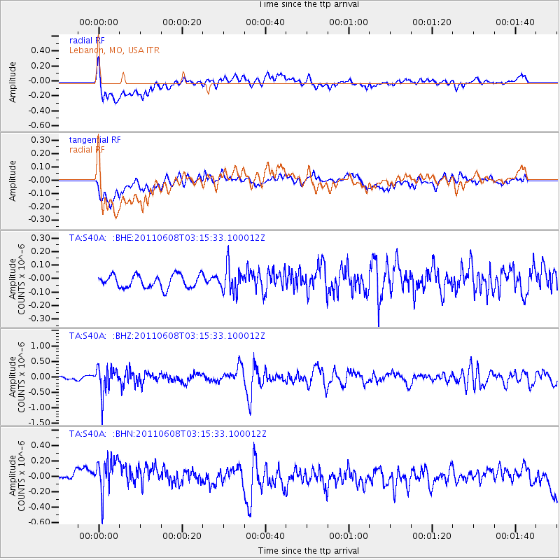
S40A Lebanon, MO, USA - Earthquake Result Viewer
*The percent match for this event was below the threshold and hence no stack was calculated.
| Earthquake location: |
Peru-Bolivia Border Region |
| Earthquake latitude/longitude: |
-17.1/-69.5 |
| Earthquake time(UTC): |
2011/06/08 (159) 03:06:22 GMT |
| Earthquake Depth: |
146 km |
| Earthquake Magnitude: |
5.8 MB, 5.9 MW, 5.9 MW |
| Earthquake Catalog/Contributor: |
WHDF/NEIC |
|
| Network: |
TA USArray Transportable Network (new EarthScope stations) |
| Station: |
S40A Lebanon, MO, USA |
| Lat/Lon: |
37.60 N/92.50 W |
| Elevation: |
336 m |
|
| Distance: |
58.5 deg |
| Az: |
338.678 deg |
| Baz: |
154.034 deg |
| Ray Param: |
$rayparam |
*The percent match for this event was below the threshold and hence was not used in the summary stack. |
|
| Radial Match: |
26.161434 % |
| Radial Bump: |
400 |
| Transverse Match: |
34.042164 % |
| Transverse Bump: |
400 |
| SOD ConfigId: |
394213 |
| Insert Time: |
2011-11-10 09:46:09.766 +0000 |
| GWidth: |
2.5 |
| Max Bumps: |
400 |
| Tol: |
0.001 |
|
Signal To Noise
| Channel | StoN | STA | LTA |
| TA:S40A: :BHZ:20110608T03:15:33.100012Z | 5.564129 | 4.2426143E-7 | 7.624939E-8 |
| TA:S40A: :BHN:20110608T03:15:33.100012Z | 1.2207621 | 3.6239035E-7 | 2.9685583E-7 |
| TA:S40A: :BHE:20110608T03:15:33.100012Z | 2.0645924 | 9.886545E-8 | 4.7886182E-8 |
| Arrivals |
| Ps | |
| PpPs | |
| PsPs/PpSs | |


