You are here: Home > Network List > TA - USArray Transportable Network (new EarthScope stations) Stations List
> Station 146A Union, MS, USA > Earthquake Result Viewer
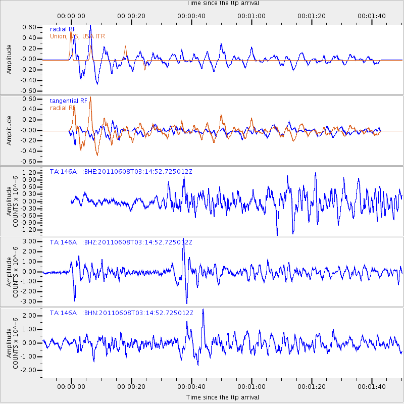
146A Union, MS, USA - Earthquake Result Viewer
*The percent match for this event was below the threshold and hence no stack was calculated.
| Earthquake location: |
Peru-Bolivia Border Region |
| Earthquake latitude/longitude: |
-17.1/-69.5 |
| Earthquake time(UTC): |
2011/06/08 (159) 03:06:22 GMT |
| Earthquake Depth: |
146 km |
| Earthquake Magnitude: |
5.8 MB, 5.9 MW, 5.9 MW |
| Earthquake Catalog/Contributor: |
WHDF/NEIC |
|
| Network: |
TA USArray Transportable Network (new EarthScope stations) |
| Station: |
146A Union, MS, USA |
| Lat/Lon: |
32.64 N/89.06 W |
| Elevation: |
164 m |
|
| Distance: |
52.9 deg |
| Az: |
339.267 deg |
| Baz: |
156.341 deg |
| Ray Param: |
$rayparam |
*The percent match for this event was below the threshold and hence was not used in the summary stack. |
|
| Radial Match: |
77.61027 % |
| Radial Bump: |
400 |
| Transverse Match: |
72.6713 % |
| Transverse Bump: |
400 |
| SOD ConfigId: |
394213 |
| Insert Time: |
2011-11-10 09:50:15.605 +0000 |
| GWidth: |
2.5 |
| Max Bumps: |
400 |
| Tol: |
0.001 |
|
Signal To Noise
| Channel | StoN | STA | LTA |
| TA:146A: :BHZ:20110608T03:14:52.725012Z | 10.541658 | 1.0510576E-6 | 9.970515E-8 |
| TA:146A: :BHN:20110608T03:14:52.725012Z | 1.7728602 | 2.7541674E-7 | 1.5535164E-7 |
| TA:146A: :BHE:20110608T03:14:52.725012Z | 2.1817286 | 2.9014336E-7 | 1.3298782E-7 |
| Arrivals |
| Ps | |
| PpPs | |
| PsPs/PpSs | |


