You are here: Home > Network List > TA - USArray Transportable Network (new EarthScope stations) Stations List
> Station S44A Carbondale, IL, USA > Earthquake Result Viewer
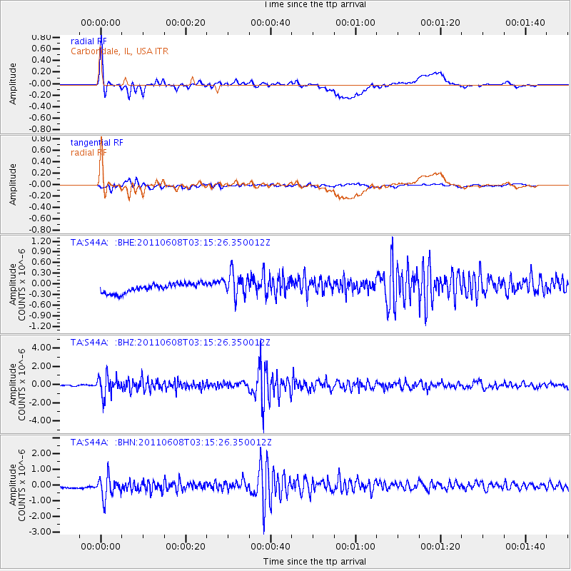
S44A Carbondale, IL, USA - Earthquake Result Viewer
*The percent match for this event was below the threshold and hence no stack was calculated.
| Earthquake location: |
Peru-Bolivia Border Region |
| Earthquake latitude/longitude: |
-17.1/-69.5 |
| Earthquake time(UTC): |
2011/06/08 (159) 03:06:22 GMT |
| Earthquake Depth: |
146 km |
| Earthquake Magnitude: |
5.8 MB, 5.9 MW, 5.9 MW |
| Earthquake Catalog/Contributor: |
WHDF/NEIC |
|
| Network: |
TA USArray Transportable Network (new EarthScope stations) |
| Station: |
S44A Carbondale, IL, USA |
| Lat/Lon: |
37.69 N/89.26 W |
| Elevation: |
155 m |
|
| Distance: |
57.6 deg |
| Az: |
341.493 deg |
| Baz: |
157.499 deg |
| Ray Param: |
$rayparam |
*The percent match for this event was below the threshold and hence was not used in the summary stack. |
|
| Radial Match: |
74.22734 % |
| Radial Bump: |
400 |
| Transverse Match: |
80.785385 % |
| Transverse Bump: |
400 |
| SOD ConfigId: |
394213 |
| Insert Time: |
2011-11-10 09:54:01.615 +0000 |
| GWidth: |
2.5 |
| Max Bumps: |
400 |
| Tol: |
0.001 |
|
Signal To Noise
| Channel | StoN | STA | LTA |
| TA:S44A: :BHZ:20110608T03:15:26.350012Z | 16.704903 | 1.0540781E-6 | 6.3099925E-8 |
| TA:S44A: :BHN:20110608T03:15:26.350012Z | 2.6865041 | 7.256956E-7 | 2.7012635E-7 |
| TA:S44A: :BHE:20110608T03:15:26.350012Z | 2.7162857 | 3.4295408E-7 | 1.2625847E-7 |
| Arrivals |
| Ps | |
| PpPs | |
| PsPs/PpSs | |


