KSM Kuching - Earthquake Result Viewer
Earthquake location: New Britain Region, P.N.G.
Earthquake latitude/longitude: -5.9/151.0
Earthquake time(UTC): 2011/06/16 (167) 00:03:35 GMT
Earthquake Depth: 16 km
Earthquake Magnitude: 6.1 MB, 6.5 MS, 6.3 MW, 6.2 MW
Earthquake Catalog/Contributor: WHDF/NEIC
Network: MY Malaysian National Seismic Network
Station: KSM Kuching
Lat/Lon: 1.47 N/110.31 E
Elevation: 66 m
Distance: 41.3 deg
Az: 278.984 deg
Baz: 100.629 deg
Ray Param: 0.07384329
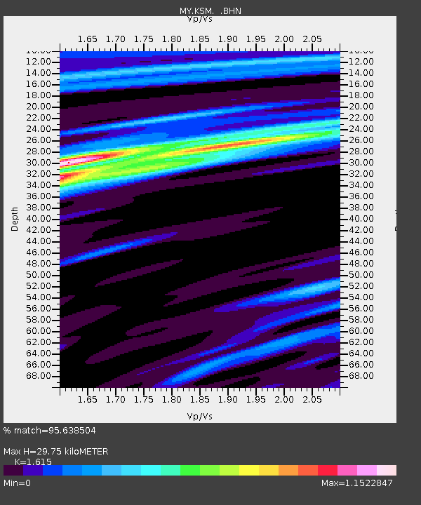
Estimated Moho Depth: 29.75 km
Estimated Crust Vp/Vs: 1.62
Assumed Crust Vp: 6.468 km/s
Estimated Crust Vs: 4.005 km/s
Estimated Crust Poisson's Ratio: 0.19
Radial Match: 95.638504 %
Radial Bump: 374
Transverse Match: 73.062584 %
Transverse Bump: 400
SOD ConfigId: 395004
Insert Time: 2011-11-27 01:30:36.065 +0000
GWidth: 2.5
Max Bumps: 400
Tol: 0.001

Signal To Noise

ChannelStoNSTALTA
MY:KSM: :BHZ:20110616T00:10:49.819999Z2.38439062.5069258E-71.0513906E-7
MY:KSM: :BHN:20110616T00:10:49.819999Z0.61877215.6679728E-89.160033E-8
MY:KSM: :BHE:20110616T00:10:49.819999Z2.04592751.6706392E-78.1656815E-8
Arrivals
Ps3.1 SECOND
PpPs11 SECOND
PsPs/PpSs14 SECOND