You are here: Home > Network List > TA - USArray Transportable Network (new EarthScope stations) Stations List
> Station A04D Lummi Island, WA, USA > Earthquake Result Viewer
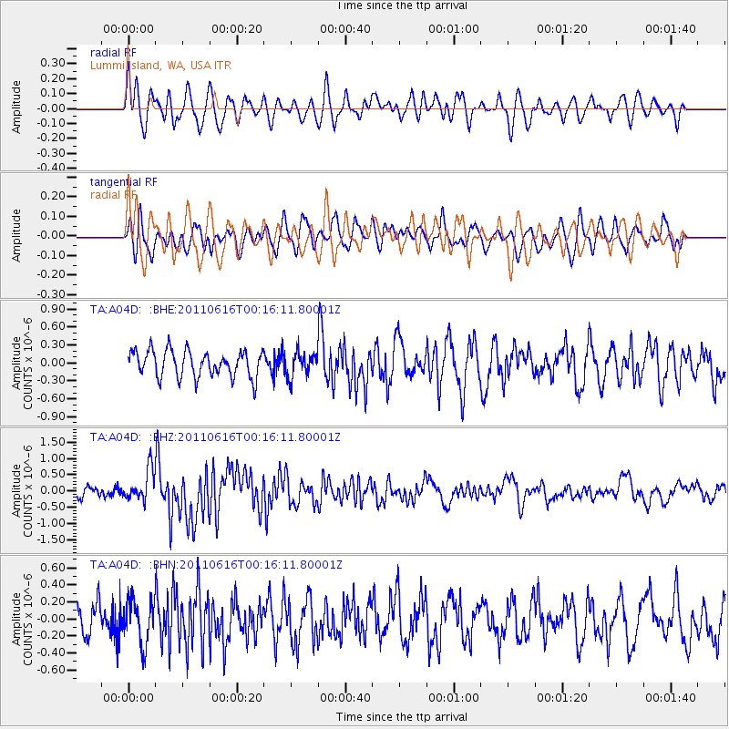
A04D Lummi Island, WA, USA - Earthquake Result Viewer
*The percent match for this event was below the threshold and hence no stack was calculated.
| Earthquake location: |
New Britain Region, P.N.G. |
| Earthquake latitude/longitude: |
-5.9/151.0 |
| Earthquake time(UTC): |
2011/06/16 (167) 00:03:35 GMT |
| Earthquake Depth: |
16 km |
| Earthquake Magnitude: |
6.1 MB, 6.5 MS, 6.3 MW, 6.2 MW |
| Earthquake Catalog/Contributor: |
WHDF/NEIC |
|
| Network: |
TA USArray Transportable Network (new EarthScope stations) |
| Station: |
A04D Lummi Island, WA, USA |
| Lat/Lon: |
48.72 N/122.71 W |
| Elevation: |
13 m |
|
| Distance: |
91.9 deg |
| Az: |
41.392 deg |
| Baz: |
263.298 deg |
| Ray Param: |
$rayparam |
*The percent match for this event was below the threshold and hence was not used in the summary stack. |
|
| Radial Match: |
59.03889 % |
| Radial Bump: |
400 |
| Transverse Match: |
61.397297 % |
| Transverse Bump: |
400 |
| SOD ConfigId: |
395004 |
| Insert Time: |
2011-11-27 01:32:47.546 +0000 |
| GWidth: |
2.5 |
| Max Bumps: |
400 |
| Tol: |
0.001 |
|
Signal To Noise
| Channel | StoN | STA | LTA |
| TA:A04D: :BHZ:20110616T00:16:11.80001Z | 3.1143339 | 4.894031E-7 | 1.5714535E-7 |
| TA:A04D: :BHN:20110616T00:16:11.80001Z | 1.5600501 | 2.5678918E-7 | 1.6460316E-7 |
| TA:A04D: :BHE:20110616T00:16:11.80001Z | 0.9068033 | 1.9991244E-7 | 2.2045843E-7 |
| Arrivals |
| Ps | |
| PpPs | |
| PsPs/PpSs | |


