You are here: Home > Network List > UW - Pacific Northwest Regional Seismic Network Stations List
> Station LEBA Lebam, WA, USA > Earthquake Result Viewer
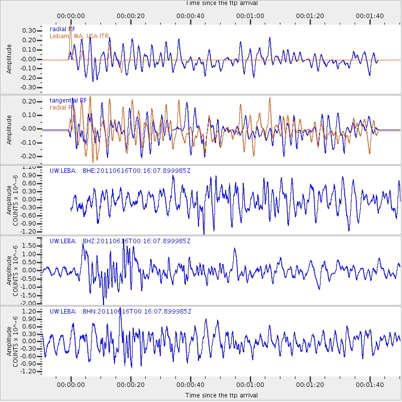
LEBA Lebam, WA, USA - Earthquake Result Viewer
*The percent match for this event was below the threshold and hence no stack was calculated.
| Earthquake location: |
New Britain Region, P.N.G. |
| Earthquake latitude/longitude: |
-5.9/151.0 |
| Earthquake time(UTC): |
2011/06/16 (167) 00:03:35 GMT |
| Earthquake Depth: |
16 km |
| Earthquake Magnitude: |
6.1 MB, 6.5 MS, 6.3 MW, 6.2 MW |
| Earthquake Catalog/Contributor: |
WHDF/NEIC |
|
| Network: |
UW Pacific Northwest Regional Seismic Network |
| Station: |
LEBA Lebam, WA, USA |
| Lat/Lon: |
46.55 N/123.56 W |
| Elevation: |
73 m |
|
| Distance: |
91.1 deg |
| Az: |
43.48 deg |
| Baz: |
262.611 deg |
| Ray Param: |
$rayparam |
*The percent match for this event was below the threshold and hence was not used in the summary stack. |
|
| Radial Match: |
58.382614 % |
| Radial Bump: |
400 |
| Transverse Match: |
51.444805 % |
| Transverse Bump: |
400 |
| SOD ConfigId: |
395004 |
| Insert Time: |
2011-11-27 01:34:37.003 +0000 |
| GWidth: |
2.5 |
| Max Bumps: |
400 |
| Tol: |
0.001 |
|
Signal To Noise
| Channel | StoN | STA | LTA |
| UW:LEBA: :BHZ:20110616T00:16:07.899985Z | 3.4654884 | 6.0033E-7 | 1.73231E-7 |
| UW:LEBA: :BHN:20110616T00:16:07.899985Z | 1.3525677 | 3.6999072E-7 | 2.7354693E-7 |
| UW:LEBA: :BHE:20110616T00:16:07.899985Z | 1.5576574 | 4.2544207E-7 | 2.7312942E-7 |
| Arrivals |
| Ps | |
| PpPs | |
| PsPs/PpSs | |


