You are here: Home > Network List > GS - US Geological Survey Networks Stations List
> Station DEC12 Boyd Road Surface Site > Earthquake Result Viewer
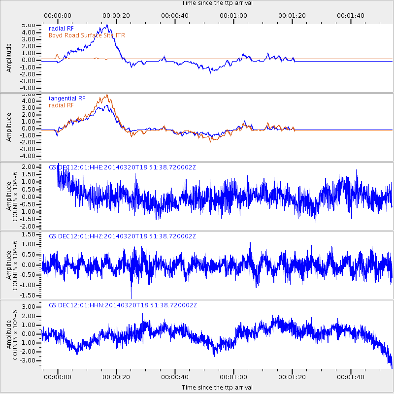
DEC12 Boyd Road Surface Site - Earthquake Result Viewer
*The percent match for this event was below the threshold and hence no stack was calculated.
| Earthquake location: |
Northern Chile |
| Earthquake latitude/longitude: |
-24.0/-69.2 |
| Earthquake time(UTC): |
2014/03/20 (079) 18:41:32 GMT |
| Earthquake Depth: |
96 km |
| Earthquake Magnitude: |
5.1 MW |
| Earthquake Catalog/Contributor: |
ISC/ISC |
|
| Network: |
GS US Geological Survey Networks |
| Station: |
DEC12 Boyd Road Surface Site |
| Lat/Lon: |
39.91 N/88.91 W |
| Elevation: |
208 m |
|
| Distance: |
66.2 deg |
| Az: |
343.533 deg |
| Baz: |
160.306 deg |
| Ray Param: |
$rayparam |
*The percent match for this event was below the threshold and hence was not used in the summary stack. |
|
| Radial Match: |
46.80086 % |
| Radial Bump: |
400 |
| Transverse Match: |
46.61501 % |
| Transverse Bump: |
400 |
| SOD ConfigId: |
3390531 |
| Insert Time: |
2019-04-10 18:56:04.791 +0000 |
| GWidth: |
2.5 |
| Max Bumps: |
400 |
| Tol: |
0.001 |
|
Signal To Noise
| Channel | StoN | STA | LTA |
| GS:DEC12:01:HHZ:20140320T18:51:38.720002Z | 0.8360827 | 2.6954552E-7 | 3.2239097E-7 |
| GS:DEC12:01:HHN:20140320T18:51:38.720002Z | 1.0085415 | 1.7417293E-6 | 1.7269783E-6 |
| GS:DEC12:01:HHE:20140320T18:51:38.720002Z | 1.4001203 | 9.0262006E-7 | 6.4467326E-7 |
| Arrivals |
| Ps | |
| PpPs | |
| PsPs/PpSs | |


