D30A Buchanan, ND, USA - Earthquake Result Viewer
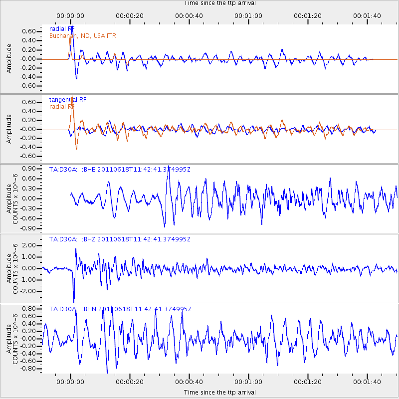
Earthquake location: Near East Coast Of Honshu, Japan
Earthquake latitude/longitude: 37.7/141.7
Earthquake time(UTC): 2011/06/18 (169) 11:31:05 GMT
Earthquake Depth: 20 km
Earthquake Magnitude: 5.9 MB, 5.4 MS, 5.8 MW, 5.6 MW
Earthquake Catalog/Contributor: WHDF/NEIC
Network: TA USArray Transportable Network (new EarthScope stations)
Station: D30A Buchanan, ND, USA
Lat/Lon: 47.11 N/98.76 W
Elevation: 465 m
Distance: 79.8 deg
Az: 37.125 deg
Baz: 315.475 deg
Ray Param: 0.048683785
Estimated Moho Depth: 30.25 km
Estimated Crust Vp/Vs: 1.76
Assumed Crust Vp: 6.53 km/s
Estimated Crust Vs: 3.716 km/s
Estimated Crust Poisson's Ratio: 0.26
Radial Match: 80.920395 %
Radial Bump: 395
Transverse Match: 48.52861 %
Transverse Bump: 386
SOD ConfigId: 395004
Insert Time: 2011-12-01 04:52:36.284 +0000
GWidth: 2.5
Max Bumps: 400
Tol: 0.001

Signal To Noise

ChannelStoNSTALTA
TA:D30A: :BHZ:20110618T11:42:41.374995Z9.5819499.180166E-79.5806875E-8
TA:D30A: :BHN:20110618T11:42:41.374995Z1.55662523.5501117E-72.2806464E-7
TA:D30A: :BHE:20110618T11:42:41.374995Z2.30481054.74649E-72.0593839E-7
Arrivals
Ps3.6 SECOND
PpPs12 SECOND
PsPs/PpSs16 SECOND