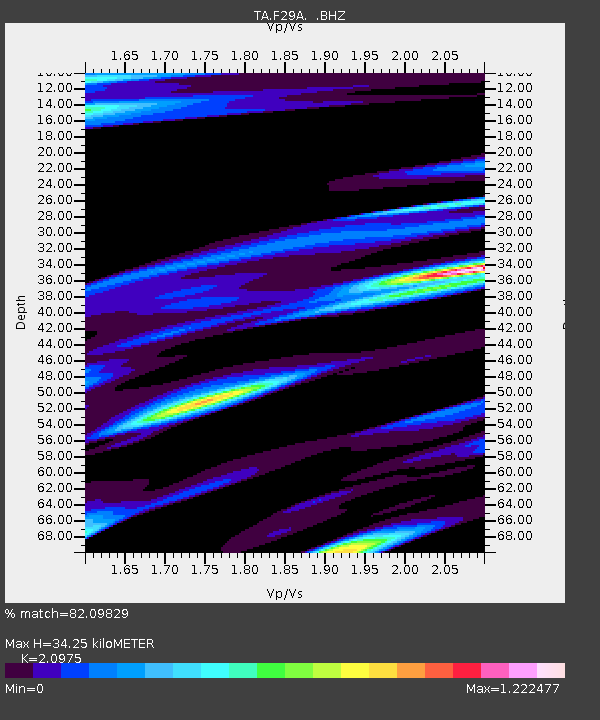
F29A Eureka, SD, USA - Earthquake Result Viewer
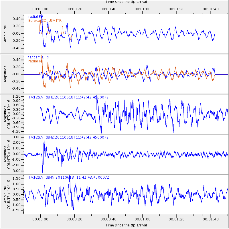
Earthquake location: Near East Coast Of Honshu, Japan
Earthquake latitude/longitude: 37.7/141.7
Earthquake time(UTC): 2011/06/18 (169) 11:31:05 GMT
Earthquake Depth: 20 km
Earthquake Magnitude: 5.9 MB, 5.4 MS, 5.8 MW, 5.6 MW
Earthquake Catalog/Contributor: WHDF/NEIC
Network: TA USArray Transportable Network (new EarthScope stations)
Station: F29A Eureka, SD, USA
Lat/Lon: 45.83 N/99.83 W
Elevation: 575 m
Distance: 80.2 deg
Az: 38.57 deg
Baz: 314.953 deg
Ray Param: 0.04842122
Estimated Moho Depth: 34.25 km
Estimated Crust Vp/Vs: 2.10
Assumed Crust Vp: 6.53 km/s
Estimated Crust Vs: 3.113 km/s
Estimated Crust Poisson's Ratio: 0.35
Radial Match: 82.09829 %
Radial Bump: 400
Transverse Match: 65.28777 %
Transverse Bump: 379
SOD ConfigId: 395004
Insert Time: 2011-12-01 04:53:39.934 +0000
GWidth: 2.5
Max Bumps: 400
Tol: 0.001

Signal To Noise

ChannelStoNSTALTA
TA:F29A: :BHZ:20110618T11:42:43.450007Z9.5687321.1867758E-61.2402644E-7
TA:F29A: :BHN:20110618T11:42:43.450007Z1.69001474.8961647E-72.8971135E-7
TA:F29A: :BHE:20110618T11:42:43.450007Z1.72442694.840744E-72.807161E-7
Arrivals
Ps5.9 SECOND
PpPs16 SECOND
PsPs/PpSs22 SECOND