You are here: Home > Network List > TA - USArray Transportable Network (new EarthScope stations) Stations List
> Station T37A Cheneyville 1850, Columbus, KS, USA > Earthquake Result Viewer
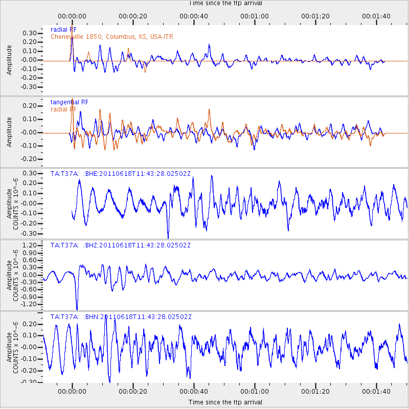
T37A Cheneyville 1850, Columbus, KS, USA - Earthquake Result Viewer
*The percent match for this event was below the threshold and hence no stack was calculated.
| Earthquake location: |
Near East Coast Of Honshu, Japan |
| Earthquake latitude/longitude: |
37.7/141.7 |
| Earthquake time(UTC): |
2011/06/18 (169) 11:31:05 GMT |
| Earthquake Depth: |
20 km |
| Earthquake Magnitude: |
5.9 MB, 5.4 MS, 5.8 MW, 5.6 MW |
| Earthquake Catalog/Contributor: |
WHDF/NEIC |
|
| Network: |
TA USArray Transportable Network (new EarthScope stations) |
| Station: |
T37A Cheneyville 1850, Columbus, KS, USA |
| Lat/Lon: |
37.12 N/94.92 W |
| Elevation: |
256 m |
|
| Distance: |
89.1 deg |
| Az: |
41.854 deg |
| Baz: |
318.511 deg |
| Ray Param: |
$rayparam |
*The percent match for this event was below the threshold and hence was not used in the summary stack. |
|
| Radial Match: |
55.59288 % |
| Radial Bump: |
400 |
| Transverse Match: |
71.179016 % |
| Transverse Bump: |
400 |
| SOD ConfigId: |
395004 |
| Insert Time: |
2011-12-01 05:04:28.515 +0000 |
| GWidth: |
2.5 |
| Max Bumps: |
400 |
| Tol: |
0.001 |
|
Signal To Noise
| Channel | StoN | STA | LTA |
| TA:T37A: :BHZ:20110618T11:43:28.02502Z | 5.0367913 | 4.861909E-7 | 9.6527906E-8 |
| TA:T37A: :BHN:20110618T11:43:28.02502Z | 1.2228262 | 1.0513287E-7 | 8.5975316E-8 |
| TA:T37A: :BHE:20110618T11:43:28.02502Z | 1.3385768 | 1.3042904E-7 | 9.7438594E-8 |
| Arrivals |
| Ps | |
| PpPs | |
| PsPs/PpSs | |


