F32A Veblen, SD, USA - Earthquake Result Viewer
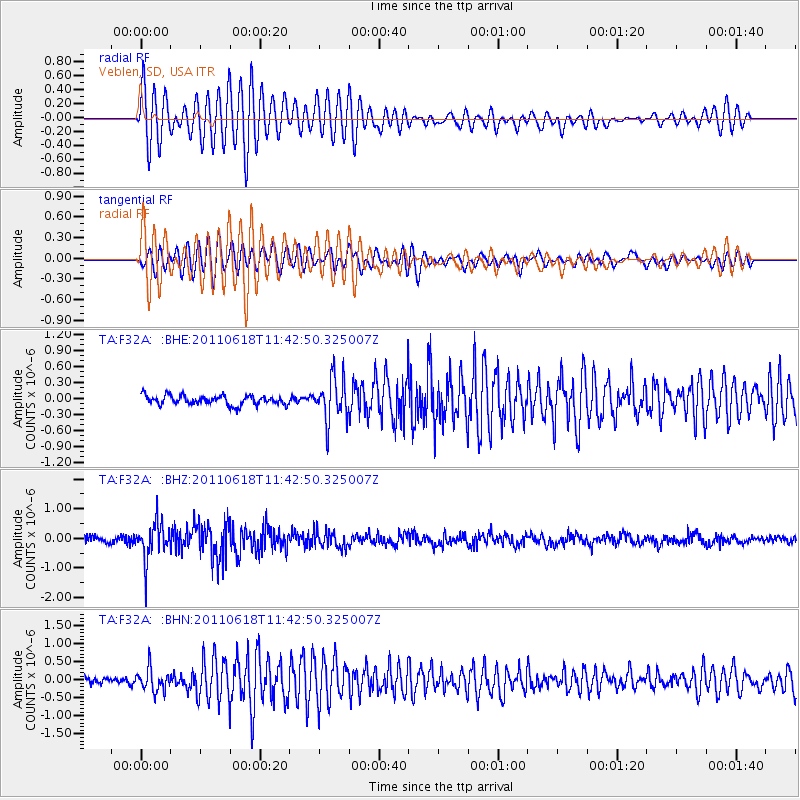
Earthquake location: Near East Coast Of Honshu, Japan
Earthquake latitude/longitude: 37.7/141.7
Earthquake time(UTC): 2011/06/18 (169) 11:31:05 GMT
Earthquake Depth: 20 km
Earthquake Magnitude: 5.9 MB, 5.4 MS, 5.8 MW, 5.6 MW
Earthquake Catalog/Contributor: WHDF/NEIC
Network: TA USArray Transportable Network (new EarthScope stations)
Station: F32A Veblen, SD, USA
Lat/Lon: 45.87 N/97.13 W
Elevation: 371 m
Distance: 81.5 deg
Az: 37.173 deg
Baz: 316.662 deg
Ray Param: 0.04753245
Estimated Moho Depth: 30.75 km
Estimated Crust Vp/Vs: 1.91
Assumed Crust Vp: 6.552 km/s
Estimated Crust Vs: 3.422 km/s
Estimated Crust Poisson's Ratio: 0.31
Radial Match: 82.73537 %
Radial Bump: 400
Transverse Match: 77.33959 %
Transverse Bump: 400
SOD ConfigId: 395004
Insert Time: 2011-12-01 05:14:59.514 +0000
GWidth: 2.5
Max Bumps: 400
Tol: 0.001

Signal To Noise

ChannelStoNSTALTA
TA:F32A: :BHZ:20110618T11:42:50.325007Z6.22581346.260768E-71.0056145E-7
TA:F32A: :BHN:20110618T11:42:50.325007Z2.37575033.0625785E-71.2890995E-7
TA:F32A: :BHE:20110618T11:42:50.325007Z4.5706524.055486E-78.872883E-8
Arrivals
Ps4.4 SECOND
PpPs13 SECOND
PsPs/PpSs18 SECOND