You are here: Home > Network List > TA - USArray Transportable Network (new EarthScope stations) Stations List
> Station M37A Trindle Farm, Earlham, IA, USA > Earthquake Result Viewer
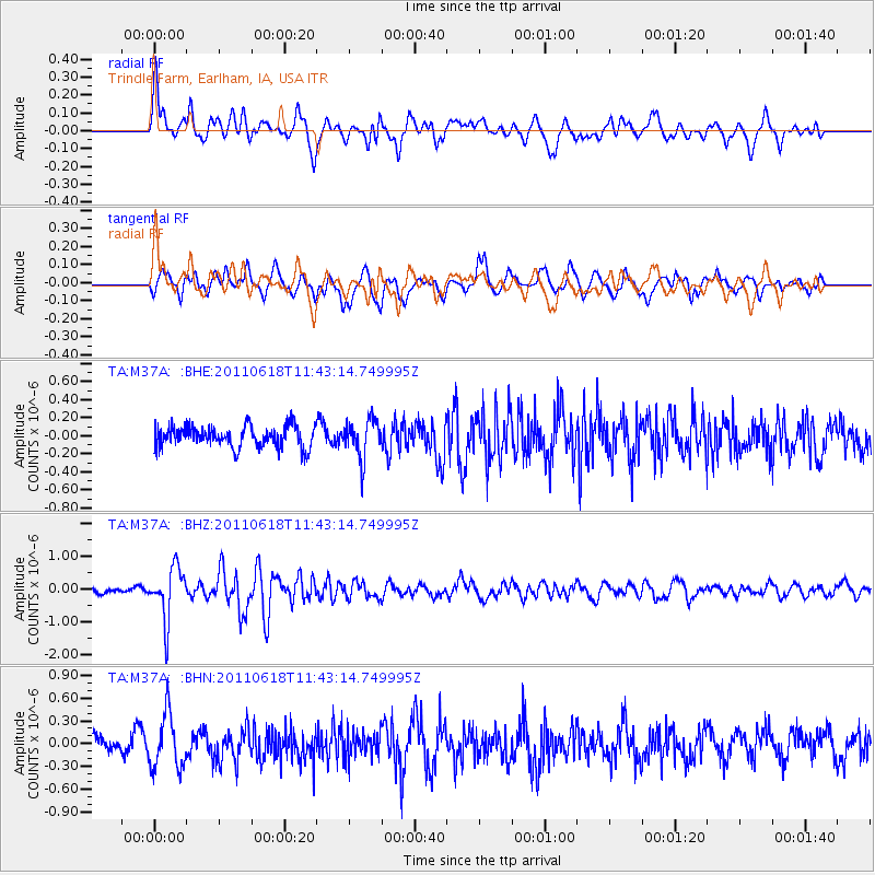
M37A Trindle Farm, Earlham, IA, USA - Earthquake Result Viewer
*The percent match for this event was below the threshold and hence no stack was calculated.
| Earthquake location: |
Near East Coast Of Honshu, Japan |
| Earthquake latitude/longitude: |
37.7/141.7 |
| Earthquake time(UTC): |
2011/06/18 (169) 11:31:05 GMT |
| Earthquake Depth: |
20 km |
| Earthquake Magnitude: |
5.9 MB, 5.4 MS, 5.8 MW, 5.6 MW |
| Earthquake Catalog/Contributor: |
WHDF/NEIC |
|
| Network: |
TA USArray Transportable Network (new EarthScope stations) |
| Station: |
M37A Trindle Farm, Earlham, IA, USA |
| Lat/Lon: |
41.40 N/94.06 W |
| Elevation: |
325 m |
|
| Distance: |
86.3 deg |
| Az: |
38.529 deg |
| Baz: |
318.919 deg |
| Ray Param: |
$rayparam |
*The percent match for this event was below the threshold and hence was not used in the summary stack. |
|
| Radial Match: |
71.652466 % |
| Radial Bump: |
400 |
| Transverse Match: |
60.53245 % |
| Transverse Bump: |
400 |
| SOD ConfigId: |
395004 |
| Insert Time: |
2011-12-01 05:15:13.196 +0000 |
| GWidth: |
2.5 |
| Max Bumps: |
400 |
| Tol: |
0.001 |
|
Signal To Noise
| Channel | StoN | STA | LTA |
| TA:M37A: :BHZ:20110618T11:43:14.749995Z | 6.1804857 | 7.795685E-7 | 1.2613386E-7 |
| TA:M37A: :BHN:20110618T11:43:14.749995Z | 2.8461003 | 3.5951516E-7 | 1.2631853E-7 |
| TA:M37A: :BHE:20110618T11:43:14.749995Z | 1.7535882 | 2.0930888E-7 | 1.1936034E-7 |
| Arrivals |
| Ps | |
| PpPs | |
| PsPs/PpSs | |


