You are here: Home > Network List > TA - USArray Transportable Network (new EarthScope stations) Stations List
> Station W45A Hickory Valley, TN, USA > Earthquake Result Viewer
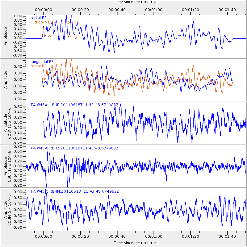
W45A Hickory Valley, TN, USA - Earthquake Result Viewer
*The percent match for this event was below the threshold and hence no stack was calculated.
| Earthquake location: |
Near East Coast Of Honshu, Japan |
| Earthquake latitude/longitude: |
37.7/141.7 |
| Earthquake time(UTC): |
2011/06/18 (169) 11:31:05 GMT |
| Earthquake Depth: |
20 km |
| Earthquake Magnitude: |
5.9 MB, 5.4 MS, 5.8 MW, 5.6 MW |
| Earthquake Catalog/Contributor: |
WHDF/NEIC |
|
| Network: |
TA USArray Transportable Network (new EarthScope stations) |
| Station: |
W45A Hickory Valley, TN, USA |
| Lat/Lon: |
35.16 N/89.19 W |
| Elevation: |
187 m |
|
| Distance: |
93.5 deg |
| Az: |
39.543 deg |
| Baz: |
321.932 deg |
| Ray Param: |
$rayparam |
*The percent match for this event was below the threshold and hence was not used in the summary stack. |
|
| Radial Match: |
56.493168 % |
| Radial Bump: |
400 |
| Transverse Match: |
46.12336 % |
| Transverse Bump: |
400 |
| SOD ConfigId: |
395004 |
| Insert Time: |
2011-12-01 05:22:02.845 +0000 |
| GWidth: |
2.5 |
| Max Bumps: |
400 |
| Tol: |
0.001 |
|
Signal To Noise
| Channel | StoN | STA | LTA |
| TA:W45A: :BHZ:20110618T11:43:48.674983Z | 3.63938 | 3.3209304E-7 | 9.1249895E-8 |
| TA:W45A: :BHN:20110618T11:43:48.674983Z | 2.016328 | 5.2831064E-7 | 2.620162E-7 |
| TA:W45A: :BHE:20110618T11:43:48.674983Z | 1.0247377 | 2.970929E-7 | 2.899209E-7 |
| Arrivals |
| Ps | |
| PpPs | |
| PsPs/PpSs | |


