You are here: Home > Network List > II - Global Seismograph Network (GSN - IRIS/IDA) Stations List
> Station TAU Hobart, Tasmania, Australia > Earthquake Result Viewer
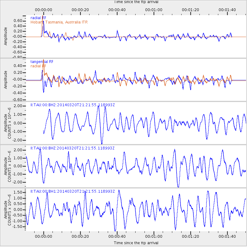
TAU Hobart, Tasmania, Australia - Earthquake Result Viewer
*The percent match for this event was below the threshold and hence no stack was calculated.
| Earthquake location: |
New Britain Region, P.N.G. |
| Earthquake latitude/longitude: |
-5.2/152.7 |
| Earthquake time(UTC): |
2014/03/20 (079) 21:15:11 GMT |
| Earthquake Depth: |
26 km |
| Earthquake Magnitude: |
5.7 MB, 5.6 MWB, 5.8 MWW, 5.8 MWC |
| Earthquake Catalog/Contributor: |
NEIC PDE/NEIC COMCAT |
|
| Network: |
II Global Seismograph Network (GSN - IRIS/IDA) |
| Station: |
TAU Hobart, Tasmania, Australia |
| Lat/Lon: |
42.91 S/147.32 E |
| Elevation: |
132 m |
|
| Distance: |
37.9 deg |
| Az: |
186.474 deg |
| Baz: |
8.792 deg |
| Ray Param: |
$rayparam |
*The percent match for this event was below the threshold and hence was not used in the summary stack. |
|
| Radial Match: |
64.10558 % |
| Radial Bump: |
400 |
| Transverse Match: |
48.9179 % |
| Transverse Bump: |
400 |
| SOD ConfigId: |
3390531 |
| Insert Time: |
2019-04-10 19:08:32.387 +0000 |
| GWidth: |
2.5 |
| Max Bumps: |
400 |
| Tol: |
0.001 |
|
Signal To Noise
| Channel | StoN | STA | LTA |
| II:TAU:00:BHZ:20140320T21:21:55.118993Z | 1.557077 | 9.717412E-7 | 6.240803E-7 |
| II:TAU:00:BH1:20140320T21:21:55.118993Z | 1.2102143 | 7.9311656E-7 | 6.5535215E-7 |
| II:TAU:00:BH2:20140320T21:21:55.118993Z | 1.7438676 | 1.4772345E-6 | 8.4710246E-7 |
| Arrivals |
| Ps | |
| PpPs | |
| PsPs/PpSs | |


