You are here: Home > Network List > G - GEOSCOPE Stations List
> Station HDC Heredia, Costa Rica > Earthquake Result Viewer
HDC Heredia, Costa Rica - Earthquake Result Viewer

| Earthquake location: |
Chile-Bolivia Border Region |
| Earthquake latitude/longitude: |
-21.7/-68.2 |
| Earthquake time(UTC): |
2011/06/20 (171) 16:36:01 GMT |
| Earthquake Depth: |
128 km |
| Earthquake Magnitude: |
6.0 MB, 6.5 MW, 6.5 MW |
| Earthquake Catalog/Contributor: |
WHDF/NEIC |
|
| Network: |
G GEOSCOPE |
| Station: |
HDC Heredia, Costa Rica |
| Lat/Lon: |
10.00 N/84.11 W |
| Elevation: |
1154 m |
|
| Distance: |
35.2 deg |
| Az: |
332.081 deg |
| Baz: |
153.764 deg |
| Ray Param: |
0.0769414 |
| Estimated Moho Depth: |
50.75 km |
| Estimated Crust Vp/Vs: |
1.77 |
| Assumed Crust Vp: |
6.597 km/s |
| Estimated Crust Vs: |
3.733 km/s |
| Estimated Crust Poisson's Ratio: |
0.26 |
|
| Radial Match: |
87.879395 % |
| Radial Bump: |
342 |
| Transverse Match: |
85.27792 % |
| Transverse Bump: |
329 |
| SOD ConfigId: |
395004 |
| Insert Time: |
2011-12-01 05:52:00.981 +0000 |
| GWidth: |
2.5 |
| Max Bumps: |
400 |
| Tol: |
0.001 |
|
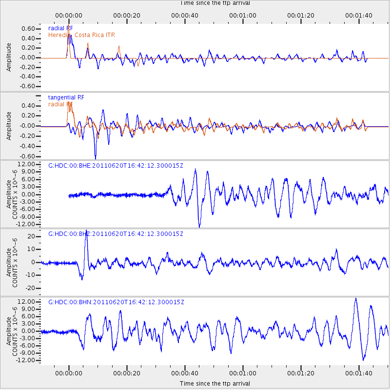
Signal To Noise
| Channel | StoN | STA | LTA |
| G:HDC:00:BHZ:20110620T16:42:12.300015Z | 10.224112 | 5.009586E-6 | 4.899776E-7 |
| G:HDC:00:BHN:20110620T16:42:12.300015Z | 7.456743 | 2.1928627E-6 | 2.940778E-7 |
| G:HDC:00:BHE:20110620T16:42:12.300015Z | 2.1864471 | 9.777169E-7 | 4.4717152E-7 |
| Arrivals |
| Ps | 6.4 SECOND |
| PpPs | 20 SECOND |
| PsPs/PpSs | 26 SECOND |


