You are here: Home > Network List > IU - Global Seismograph Network (GSN - IRIS/USGS) Stations List
> Station JOHN Johnston Island, USA > Earthquake Result Viewer
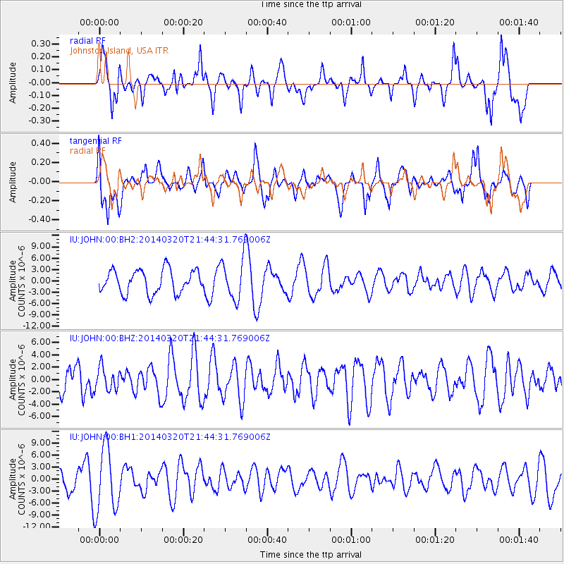
JOHN Johnston Island, USA - Earthquake Result Viewer
*The percent match for this event was below the threshold and hence no stack was calculated.
| Earthquake location: |
South Of Bali, Indonesia |
| Earthquake latitude/longitude: |
-9.6/114.2 |
| Earthquake time(UTC): |
2014/03/20 (079) 21:33:01 GMT |
| Earthquake Depth: |
66 km |
| Earthquake Magnitude: |
5.1 MW |
| Earthquake Catalog/Contributor: |
ISC/ISC |
|
| Network: |
IU Global Seismograph Network (GSN - IRIS/USGS) |
| Station: |
JOHN Johnston Island, USA |
| Lat/Lon: |
16.73 N/169.53 W |
| Elevation: |
2.0 m |
|
| Distance: |
79.8 deg |
| Az: |
71.024 deg |
| Baz: |
256.702 deg |
| Ray Param: |
$rayparam |
*The percent match for this event was below the threshold and hence was not used in the summary stack. |
|
| Radial Match: |
62.64911 % |
| Radial Bump: |
400 |
| Transverse Match: |
52.213993 % |
| Transverse Bump: |
400 |
| SOD ConfigId: |
3390531 |
| Insert Time: |
2019-04-10 19:12:04.626 +0000 |
| GWidth: |
2.5 |
| Max Bumps: |
400 |
| Tol: |
0.001 |
|
Signal To Noise
| Channel | StoN | STA | LTA |
| IU:JOHN:00:BHZ:20140320T21:44:31.769006Z | 0.74181336 | 1.8485664E-6 | 2.4919561E-6 |
| IU:JOHN:00:BH1:20140320T21:44:31.769006Z | 4.1328225 | 7.914084E-6 | 1.9149343E-6 |
| IU:JOHN:00:BH2:20140320T21:44:31.769006Z | 1.847334 | 5.579911E-6 | 3.020521E-6 |
| Arrivals |
| Ps | |
| PpPs | |
| PsPs/PpSs | |


