You are here: Home > Network List > KN - Kyrgyz Seismic Telemetry Network Stations List
> Station TKM2 - > Earthquake Result Viewer
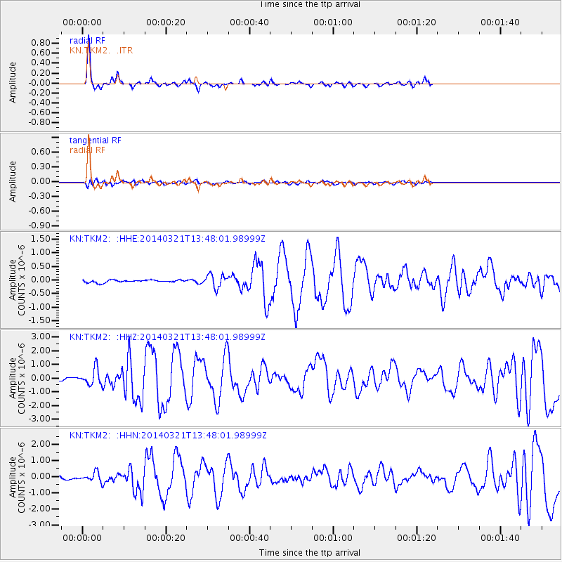
TKM2 - - Earthquake Result Viewer
*The percent match for this event was below the threshold and hence no stack was calculated.
| Earthquake location: |
Nicobar Islands, India Region |
| Earthquake latitude/longitude: |
7.8/94.3 |
| Earthquake time(UTC): |
2014/03/21 (080) 13:41:07 GMT |
| Earthquake Depth: |
10 km |
| Earthquake Magnitude: |
6.5 MWB, 6.4 MWC, 6.4 MWB, 6.4 MWW |
| Earthquake Catalog/Contributor: |
NEIC PDE/NEIC COMCAT |
|
| Network: |
KN Kyrgyz Seismic Telemetry Network |
| Station: |
TKM2 - |
| Lat/Lon: |
42.92 N/75.60 E |
| Elevation: |
2020 m |
|
| Distance: |
38.7 deg |
| Az: |
337.835 deg |
| Baz: |
149.407 deg |
| Ray Param: |
$rayparam |
*The percent match for this event was below the threshold and hence was not used in the summary stack. |
|
| Radial Match: |
92.397575 % |
| Radial Bump: |
230 |
| Transverse Match: |
75.624794 % |
| Transverse Bump: |
400 |
| SOD ConfigId: |
3390531 |
| Insert Time: |
2019-04-10 19:15:34.418 +0000 |
| GWidth: |
2.5 |
| Max Bumps: |
400 |
| Tol: |
0.001 |
|
Signal To Noise
| Channel | StoN | STA | LTA |
| KN:TKM2: :HHZ:20140321T13:48:01.98999Z | 4.844738 | 6.0529453E-7 | 1.2493855E-7 |
| KN:TKM2: :HHN:20140321T13:48:01.98999Z | 2.5303123 | 2.9541343E-7 | 1.1674978E-7 |
| KN:TKM2: :HHE:20140321T13:48:01.98999Z | 5.234685 | 2.3188451E-7 | 4.4297703E-8 |
| Arrivals |
| Ps | |
| PpPs | |
| PsPs/PpSs | |


