You are here: Home > Network List > TA - USArray Transportable Network (new EarthScope stations) Stations List
> Station J05D Fort Rock, OR, USA > Earthquake Result Viewer
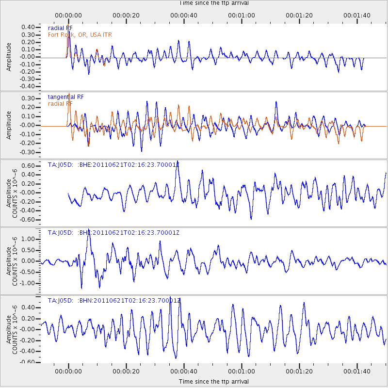
J05D Fort Rock, OR, USA - Earthquake Result Viewer
*The percent match for this event was below the threshold and hence no stack was calculated.
| Earthquake location: |
Santa Cruz Islands |
| Earthquake latitude/longitude: |
-11.5/165.6 |
| Earthquake time(UTC): |
2011/06/21 (172) 02:04:15 GMT |
| Earthquake Depth: |
14 km |
| Earthquake Magnitude: |
5.8 MB, 5.8 MS, 6.0 MW, 6.0 MW |
| Earthquake Catalog/Contributor: |
WHDF/NEIC |
|
| Network: |
TA USArray Transportable Network (new EarthScope stations) |
| Station: |
J05D Fort Rock, OR, USA |
| Lat/Lon: |
43.28 N/121.23 W |
| Elevation: |
1541 m |
|
| Distance: |
85.9 deg |
| Az: |
44.502 deg |
| Baz: |
250.205 deg |
| Ray Param: |
$rayparam |
*The percent match for this event was below the threshold and hence was not used in the summary stack. |
|
| Radial Match: |
61.5209 % |
| Radial Bump: |
400 |
| Transverse Match: |
75.59697 % |
| Transverse Bump: |
400 |
| SOD ConfigId: |
395004 |
| Insert Time: |
2011-12-01 07:19:05.309 +0000 |
| GWidth: |
2.5 |
| Max Bumps: |
400 |
| Tol: |
0.001 |
|
Signal To Noise
| Channel | StoN | STA | LTA |
| TA:J05D: :BHZ:20110621T02:16:23.70001Z | 3.4872513 | 3.3986265E-7 | 9.745861E-8 |
| TA:J05D: :BHN:20110621T02:16:23.70001Z | 0.89320505 | 9.7149645E-8 | 1.0876522E-7 |
| TA:J05D: :BHE:20110621T02:16:23.70001Z | 1.3015974 | 1.6078134E-7 | 1.2352618E-7 |
| Arrivals |
| Ps | |
| PpPs | |
| PsPs/PpSs | |


