You are here: Home > Network List > TA - USArray Transportable Network (new EarthScope stations) Stations List
> Station O48A Farmland, IN, USA > Earthquake Result Viewer
O48A Farmland, IN, USA - Earthquake Result Viewer
*The percent match for this event was below the threshold and hence no stack was calculated.
| Earthquake location: |
Near Coast Of Northern Peru |
| Earthquake latitude/longitude: |
-5.6/-81.0 |
| Earthquake time(UTC): |
2014/03/22 (081) 00:38:45 GMT |
| Earthquake Depth: |
37 km |
| Earthquake Magnitude: |
4.9 mb |
| Earthquake Catalog/Contributor: |
ISC/ISC |
|
| Network: |
TA USArray Transportable Network (new EarthScope stations) |
| Station: |
O48A Farmland, IN, USA |
| Lat/Lon: |
40.26 N/85.16 W |
| Elevation: |
300 m |
|
| Distance: |
45.8 deg |
| Az: |
355.514 deg |
| Baz: |
174.162 deg |
| Ray Param: |
$rayparam |
*The percent match for this event was below the threshold and hence was not used in the summary stack. |
|
| Radial Match: |
46.462215 % |
| Radial Bump: |
400 |
| Transverse Match: |
71.30512 % |
| Transverse Bump: |
400 |
| SOD ConfigId: |
3390531 |
| Insert Time: |
2019-04-10 19:39:13.232 +0000 |
| GWidth: |
2.5 |
| Max Bumps: |
400 |
| Tol: |
0.001 |
|
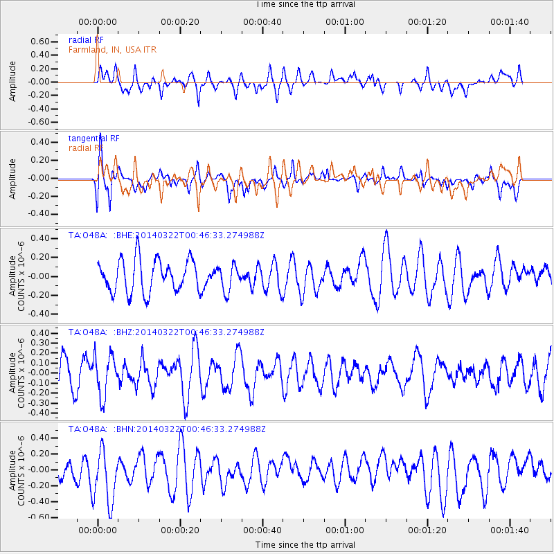
Signal To Noise
| Channel | StoN | STA | LTA |
| TA:O48A: :BHZ:20140322T00:46:33.274988Z | 1.0144536 | 2.0751337E-7 | 2.0455677E-7 |
| TA:O48A: :BHN:20140322T00:46:33.274988Z | 2.75406 | 3.54676E-7 | 1.2878296E-7 |
| TA:O48A: :BHE:20140322T00:46:33.274988Z | 0.7943913 | 1.3694779E-7 | 1.7239337E-7 |
| Arrivals |
| Ps | |
| PpPs | |
| PsPs/PpSs | |


