You are here: Home > Network List > TA - USArray Transportable Network (new EarthScope stations) Stations List
> Station V60A Jim Taylor Road, Stokes, NC, USA > Earthquake Result Viewer
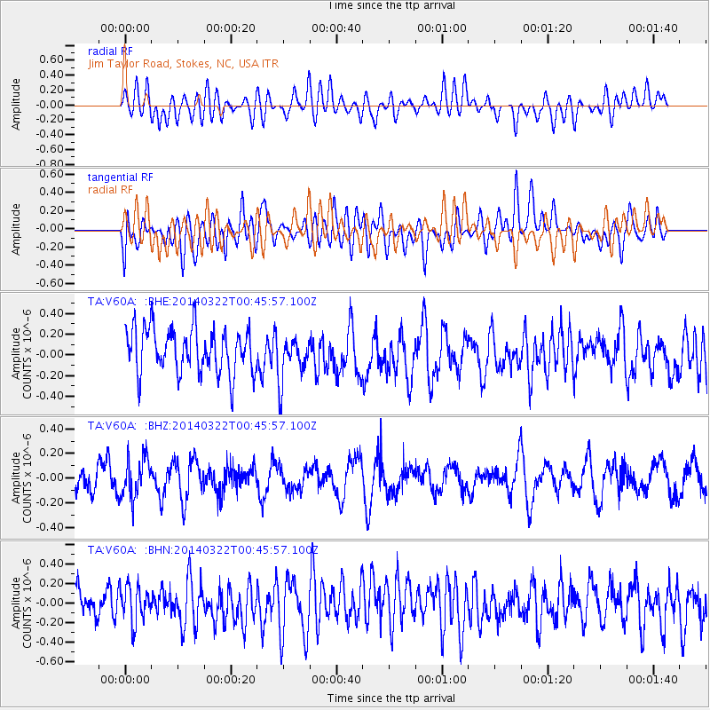
V60A Jim Taylor Road, Stokes, NC, USA - Earthquake Result Viewer
*The percent match for this event was below the threshold and hence no stack was calculated.
| Earthquake location: |
Near Coast Of Northern Peru |
| Earthquake latitude/longitude: |
-5.6/-81.0 |
| Earthquake time(UTC): |
2014/03/22 (081) 00:38:45 GMT |
| Earthquake Depth: |
37 km |
| Earthquake Magnitude: |
4.9 mb |
| Earthquake Catalog/Contributor: |
ISC/ISC |
|
| Network: |
TA USArray Transportable Network (new EarthScope stations) |
| Station: |
V60A Jim Taylor Road, Stokes, NC, USA |
| Lat/Lon: |
35.76 N/77.26 W |
| Elevation: |
8.0 m |
|
| Distance: |
41.3 deg |
| Az: |
4.548 deg |
| Baz: |
185.569 deg |
| Ray Param: |
$rayparam |
*The percent match for this event was below the threshold and hence was not used in the summary stack. |
|
| Radial Match: |
44.12259 % |
| Radial Bump: |
400 |
| Transverse Match: |
49.08676 % |
| Transverse Bump: |
400 |
| SOD ConfigId: |
3390531 |
| Insert Time: |
2019-04-10 19:39:34.240 +0000 |
| GWidth: |
2.5 |
| Max Bumps: |
400 |
| Tol: |
0.001 |
|
Signal To Noise
| Channel | StoN | STA | LTA |
| TA:V60A: :BHZ:20140322T00:45:57.100Z | 1.5628815 | 1.6350916E-7 | 1.0462032E-7 |
| TA:V60A: :BHN:20140322T00:45:57.100Z | 1.0451574 | 1.9189493E-7 | 1.8360385E-7 |
| TA:V60A: :BHE:20140322T00:45:57.100Z | 1.0337539 | 2.2416737E-7 | 2.168479E-7 |
| Arrivals |
| Ps | |
| PpPs | |
| PsPs/PpSs | |


