You are here: Home > Network List > TA - USArray Transportable Network (new EarthScope stations) Stations List
> Station W57A Gilead, NC, USA > Earthquake Result Viewer
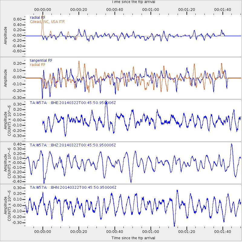
W57A Gilead, NC, USA - Earthquake Result Viewer
*The percent match for this event was below the threshold and hence no stack was calculated.
| Earthquake location: |
Near Coast Of Northern Peru |
| Earthquake latitude/longitude: |
-5.6/-81.0 |
| Earthquake time(UTC): |
2014/03/22 (081) 00:38:45 GMT |
| Earthquake Depth: |
37 km |
| Earthquake Magnitude: |
4.9 mb |
| Earthquake Catalog/Contributor: |
ISC/ISC |
|
| Network: |
TA USArray Transportable Network (new EarthScope stations) |
| Station: |
W57A Gilead, NC, USA |
| Lat/Lon: |
35.15 N/79.99 W |
| Elevation: |
85 m |
|
| Distance: |
40.6 deg |
| Az: |
1.21 deg |
| Baz: |
181.47 deg |
| Ray Param: |
$rayparam |
*The percent match for this event was below the threshold and hence was not used in the summary stack. |
|
| Radial Match: |
49.11067 % |
| Radial Bump: |
400 |
| Transverse Match: |
54.8485 % |
| Transverse Bump: |
400 |
| SOD ConfigId: |
3390531 |
| Insert Time: |
2019-04-10 19:39:35.844 +0000 |
| GWidth: |
2.5 |
| Max Bumps: |
400 |
| Tol: |
0.001 |
|
Signal To Noise
| Channel | StoN | STA | LTA |
| TA:W57A: :BHZ:20140322T00:45:50.950006Z | 1.9252769 | 2.3266263E-7 | 1.2084632E-7 |
| TA:W57A: :BHN:20140322T00:45:50.950006Z | 1.0473007 | 1.01559905E-7 | 9.697301E-8 |
| TA:W57A: :BHE:20140322T00:45:50.950006Z | 1.013033 | 9.200092E-8 | 9.0817295E-8 |
| Arrivals |
| Ps | |
| PpPs | |
| PsPs/PpSs | |


