ATD Arta Cave, Djibouti - Earthquake Result Viewer
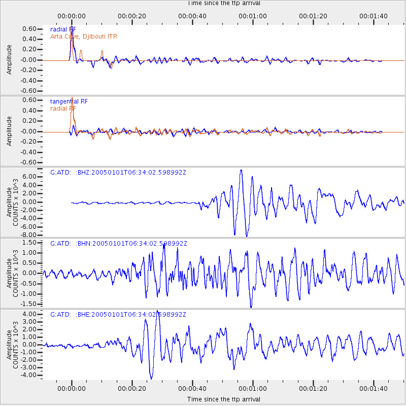
Earthquake location: Off W Coast Of Northern Sumatra
Earthquake latitude/longitude: 5.1/92.3
Earthquake time(UTC): 2005/01/01 (001) 06:25:44 GMT
Earthquake Depth: 12 km
Earthquake Magnitude: 6.0 MB, 6.7 MS, 6.6 MW, 6.5 MW
Earthquake Catalog/Contributor: WHDF/NEIC
Network: G GEOSCOPE
Station: ATD Arta Cave, Djibouti
Lat/Lon: 11.53 N/42.85 E
Elevation: 610 m
Distance: 49.3 deg
Az: 280.763 deg
Baz: 93.18 deg
Ray Param: 0.06878474
Estimated Moho Depth: 67.75 km
Estimated Crust Vp/Vs: 1.90
Assumed Crust Vp: 6.375 km/s
Estimated Crust Vs: 3.355 km/s
Estimated Crust Poisson's Ratio: 0.31
Radial Match: 97.36324 %
Radial Bump: 400
Transverse Match: 83.49337 %
Transverse Bump: 400
SOD ConfigId: 39739
Insert Time: 2010-02-26 21:26:42.416 +0000
GWidth: 2.5
Max Bumps: 400
Tol: 0.001

Signal To Noise

ChannelStoNSTALTA
G:ATD: :BHN:20050101T06:34:02.598992Z0.7685941111.34131144.8636
G:ATD: :BHE:20050101T06:34:02.598992Z0.9269155105.3141113.6178
G:ATD: :BHZ:20050101T06:34:02.598992Z1.4625863193.19989132.0947
Arrivals
Ps10 SECOND
PpPs29 SECOND
PsPs/PpSs39 SECOND