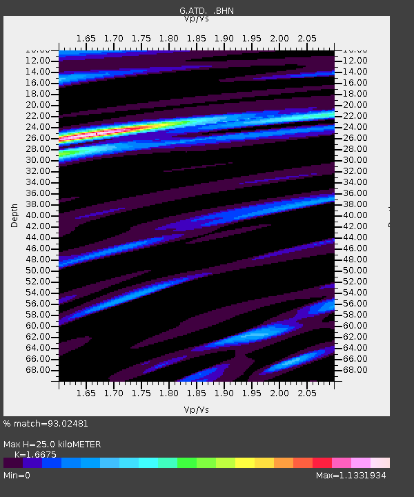
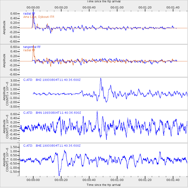
ATD Arta Cave, Djibouti - Earthquake Result Viewer

Earthquake location: Southern Sumatra, Indonesia
Earthquake latitude/longitude: -1.6/99.7
Earthquake time(UTC): 1993/08/04 (216) 11:31:18 GMT
Earthquake Depth: 33 km
Earthquake Magnitude: 5.9 MB, 6.4 MS, 6.2 UNKNOWN, 6.4 MW
Earthquake Catalog/Contributor: WHDF/NEIC
Network: G GEOSCOPE
Station: ATD Arta Cave, Djibouti
Lat/Lon: 11.53 N/42.85 E
Elevation: 610 m
Distance: 58.0 deg
Az: 284.592 deg
Baz: 99.241 deg
Ray Param: 0.06309385
Estimated Moho Depth: 25.0 km
Estimated Crust Vp/Vs: 1.67
Assumed Crust Vp: 6.375 km/s
Estimated Crust Vs: 3.823 km/s
Estimated Crust Poisson's Ratio: 0.22
Radial Match: 93.02481 %
Radial Bump: 400
Transverse Match: 65.62362 %
Transverse Bump: 400
SOD ConfigId: 16938
Insert Time: 2010-02-26 21:26:53.742 +0000
GWidth: 2.5
Max Bumps: 400
Tol: 0.001

Signal To Noise

ChannelStoNSTALTA
G:ATD: :BHN:19930804T11:40:36.600Z0.49631161.1574541E-72.3321117E-7
G:ATD: :BHE:19930804T11:40:36.600Z1.4541782.1067837E-71.4487799E-7
G:ATD: :BHZ:19930804T11:40:36.600Z1.97343022.3586377E-71.195197E-7
Arrivals
Ps2.8 SECOND
PpPs9.9 SECOND
PsPs/PpSs13 SECOND