You are here: Home > Network List > TA - USArray Transportable Network (new EarthScope stations) Stations List
> Station Q39A Willow Grove Farm, Nelson, MO, USA > Earthquake Result Viewer
Q39A Willow Grove Farm, Nelson, MO, USA - Earthquake Result Viewer

| Earthquake location: |
Fox Islands, Aleutian Islands |
| Earthquake latitude/longitude: |
52.0/-171.8 |
| Earthquake time(UTC): |
2011/06/24 (175) 03:09:39 GMT |
| Earthquake Depth: |
52 km |
| Earthquake Magnitude: |
6.9 MB, 7.3 MW, 7.3 MW |
| Earthquake Catalog/Contributor: |
WHDF/NEIC |
|
| Network: |
TA USArray Transportable Network (new EarthScope stations) |
| Station: |
Q39A Willow Grove Farm, Nelson, MO, USA |
| Lat/Lon: |
39.05 N/92.98 W |
| Elevation: |
225 m |
|
| Distance: |
54.1 deg |
| Az: |
70.597 deg |
| Baz: |
311.583 deg |
| Ray Param: |
0.06553553 |
| Estimated Moho Depth: |
49.25 km |
| Estimated Crust Vp/Vs: |
1.65 |
| Assumed Crust Vp: |
6.498 km/s |
| Estimated Crust Vs: |
3.926 km/s |
| Estimated Crust Poisson's Ratio: |
0.21 |
|
| Radial Match: |
97.75408 % |
| Radial Bump: |
335 |
| Transverse Match: |
88.51649 % |
| Transverse Bump: |
400 |
| SOD ConfigId: |
395004 |
| Insert Time: |
2011-12-01 08:46:28.840 +0000 |
| GWidth: |
2.5 |
| Max Bumps: |
400 |
| Tol: |
0.001 |
|
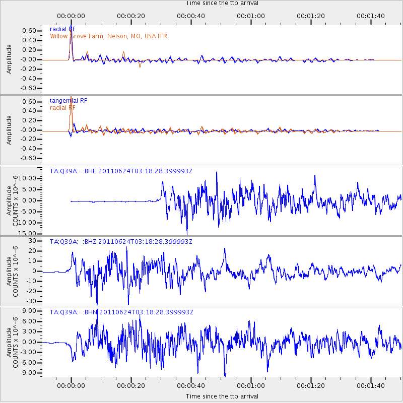
Signal To Noise
| Channel | StoN | STA | LTA |
| TA:Q39A: :BHZ:20110624T03:18:28.399993Z | 39.316803 | 9.256086E-6 | 2.3542316E-7 |
| TA:Q39A: :BHN:20110624T03:18:28.399993Z | 18.135086 | 2.758995E-6 | 1.5213575E-7 |
| TA:Q39A: :BHE:20110624T03:18:28.399993Z | 36.109104 | 4.1512517E-6 | 1.1496413E-7 |
| Arrivals |
| Ps | 5.3 SECOND |
| PpPs | 19 SECOND |
| PsPs/PpSs | 24 SECOND |


