MVL Millersville University, PA - Earthquake Result Viewer
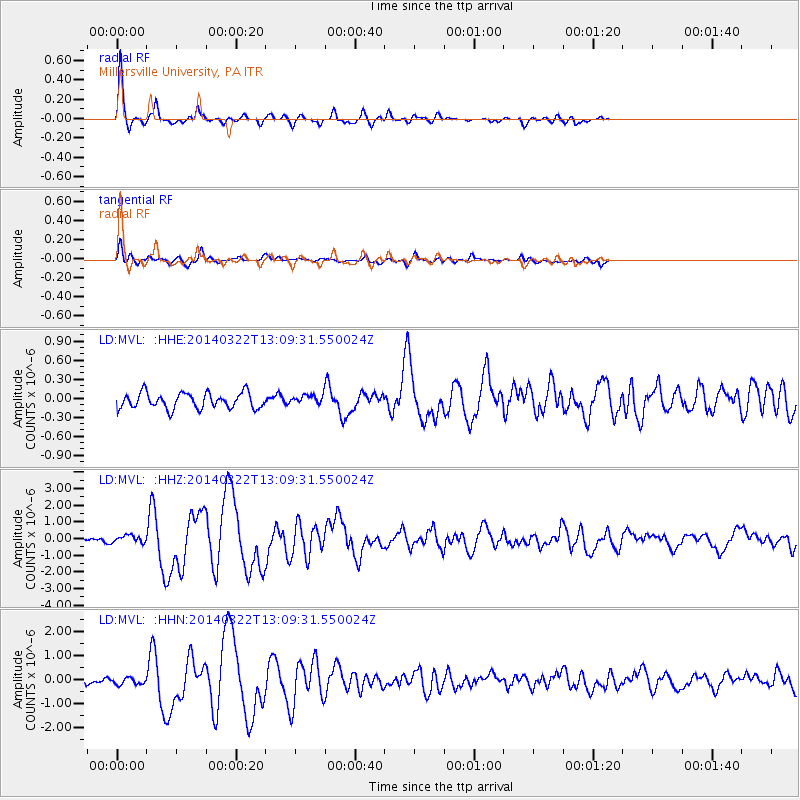
Earthquake location: Near Coast Of Northern Chile
Earthquake latitude/longitude: -19.8/-70.9
Earthquake time(UTC): 2014/03/22 (081) 12:59:59 GMT
Earthquake Depth: 20 km
Earthquake Magnitude: 6.2 MWW, 6.2 MWB, 6.3 MWC, 6.4 MWC
Earthquake Catalog/Contributor: NEIC PDE/NEIC COMCAT
Network: LD Lamont-Doherty Cooperative Seismographic Network
Station: MVL Millersville University, PA
Lat/Lon: 40.00 N/76.35 W
Elevation: 91 m
Distance: 59.7 deg
Az: 355.127 deg
Baz: 174.022 deg
Ray Param: 0.062012948
Estimated Moho Depth: 58.5 km
Estimated Crust Vp/Vs: 1.64
Assumed Crust Vp: 6.419 km/s
Estimated Crust Vs: 3.908 km/s
Estimated Crust Poisson's Ratio: 0.21
Radial Match: 93.861084 %
Radial Bump: 258
Transverse Match: 84.07174 %
Transverse Bump: 400
SOD ConfigId: 3390531
Insert Time: 2019-04-10 19:48:47.630 +0000
GWidth: 2.5
Max Bumps: 400
Tol: 0.001

Signal To Noise

ChannelStoNSTALTA
LD:MVL: :HHZ:20140322T13:09:31.550024Z1.77022452.1888044E-71.2364559E-7
LD:MVL: :HHN:20140322T13:09:31.550024Z0.929590641.389491E-71.4947344E-7
LD:MVL: :HHE:20140322T13:09:31.550024Z0.514547946.411818E-81.2461072E-7
Arrivals
Ps6.2 SECOND
PpPs23 SECOND
PsPs/PpSs29 SECOND