You are here: Home > Network List > TA - USArray Transportable Network (new EarthScope stations) Stations List
> Station Y44A Strider, Charleston, MS, USA > Earthquake Result Viewer
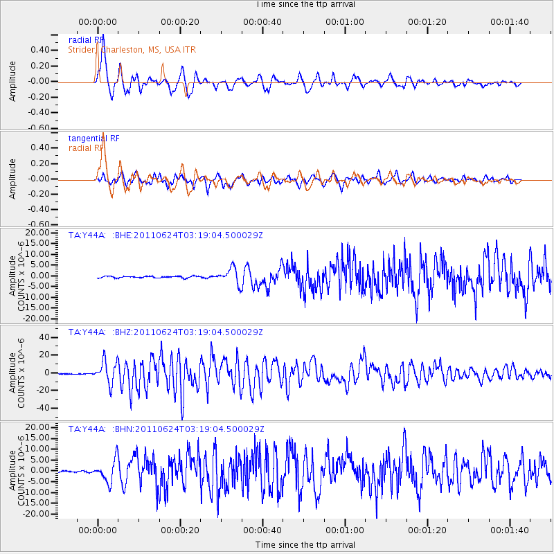
Y44A Strider, Charleston, MS, USA - Earthquake Result Viewer
*The percent match for this event was below the threshold and hence no stack was calculated.
| Earthquake location: |
Fox Islands, Aleutian Islands |
| Earthquake latitude/longitude: |
52.0/-171.8 |
| Earthquake time(UTC): |
2011/06/24 (175) 03:09:39 GMT |
| Earthquake Depth: |
52 km |
| Earthquake Magnitude: |
6.9 MB, 7.3 MW, 7.3 MW |
| Earthquake Catalog/Contributor: |
WHDF/NEIC |
|
| Network: |
TA USArray Transportable Network (new EarthScope stations) |
| Station: |
Y44A Strider, Charleston, MS, USA |
| Lat/Lon: |
33.96 N/90.21 W |
| Elevation: |
46 m |
|
| Distance: |
59.2 deg |
| Az: |
73.206 deg |
| Baz: |
314.658 deg |
| Ray Param: |
$rayparam |
*The percent match for this event was below the threshold and hence was not used in the summary stack. |
|
| Radial Match: |
94.99634 % |
| Radial Bump: |
400 |
| Transverse Match: |
90.448326 % |
| Transverse Bump: |
400 |
| SOD ConfigId: |
395004 |
| Insert Time: |
2011-12-01 08:53:42.550 +0000 |
| GWidth: |
2.5 |
| Max Bumps: |
400 |
| Tol: |
0.001 |
|
Signal To Noise
| Channel | StoN | STA | LTA |
| TA:Y44A: :BHZ:20110624T03:19:04.500029Z | 111.829 | 1.31895495E-5 | 1.1794391E-7 |
| TA:Y44A: :BHN:20110624T03:19:04.500029Z | 22.407263 | 5.2600967E-6 | 2.3474963E-7 |
| TA:Y44A: :BHE:20110624T03:19:04.500029Z | 10.033686 | 3.81957E-6 | 3.8067466E-7 |
| Arrivals |
| Ps | |
| PpPs | |
| PsPs/PpSs | |


